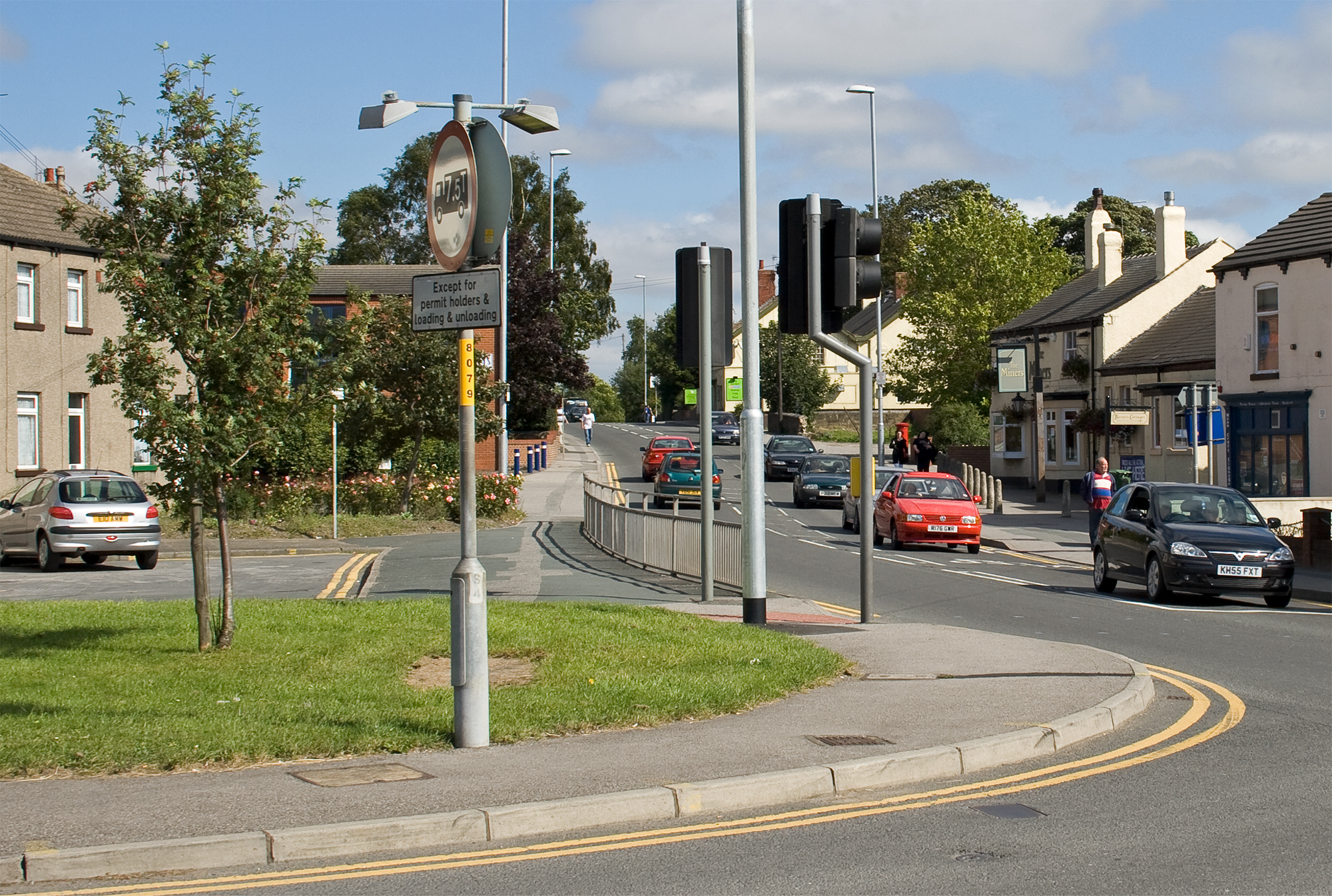
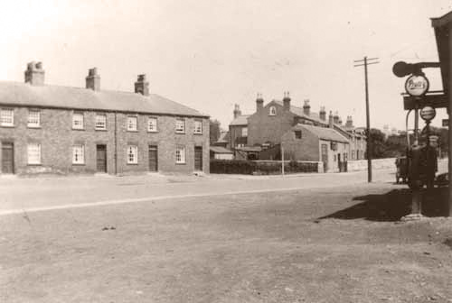
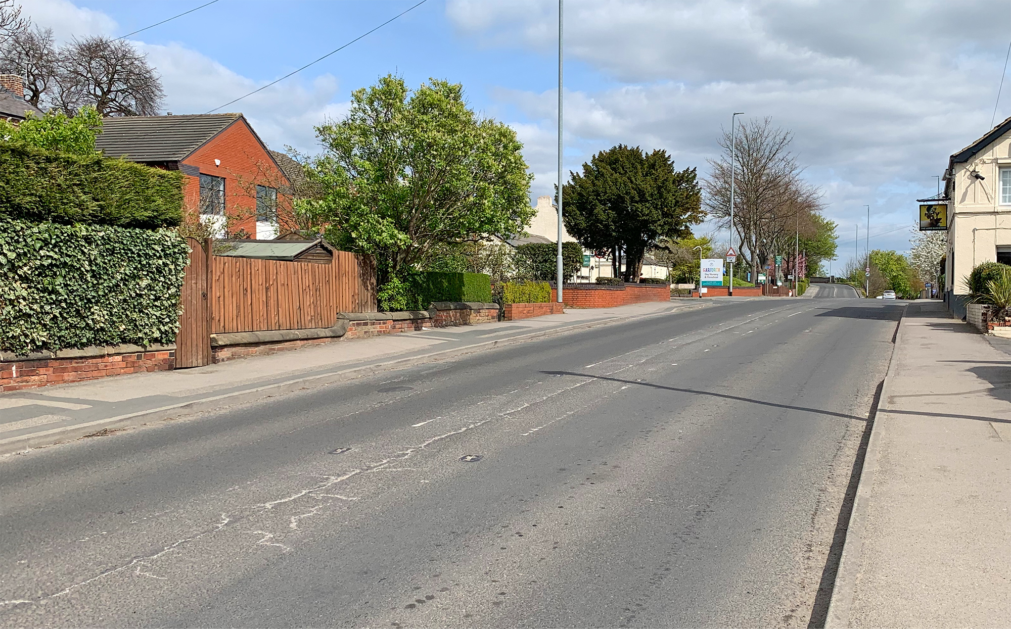
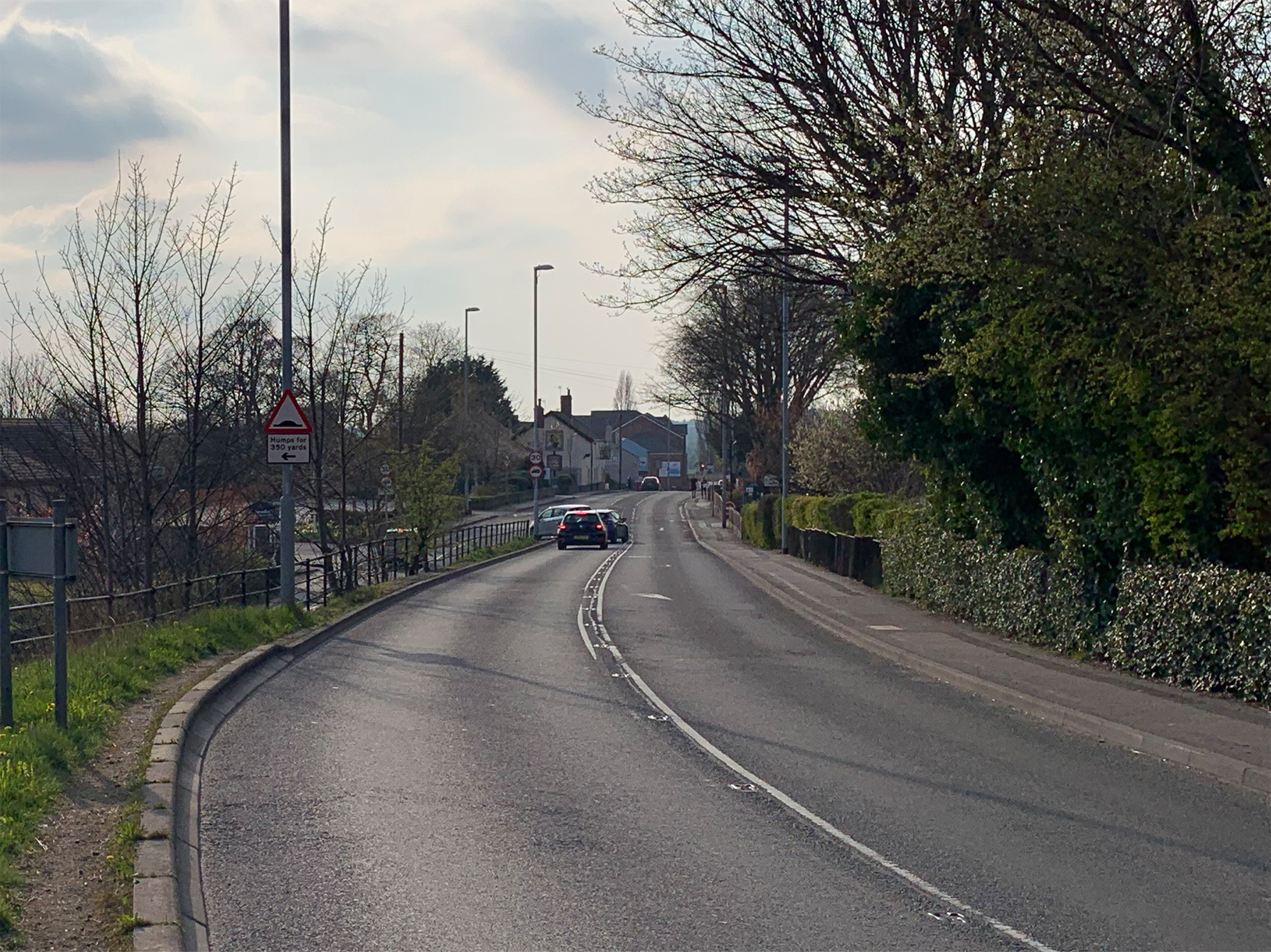
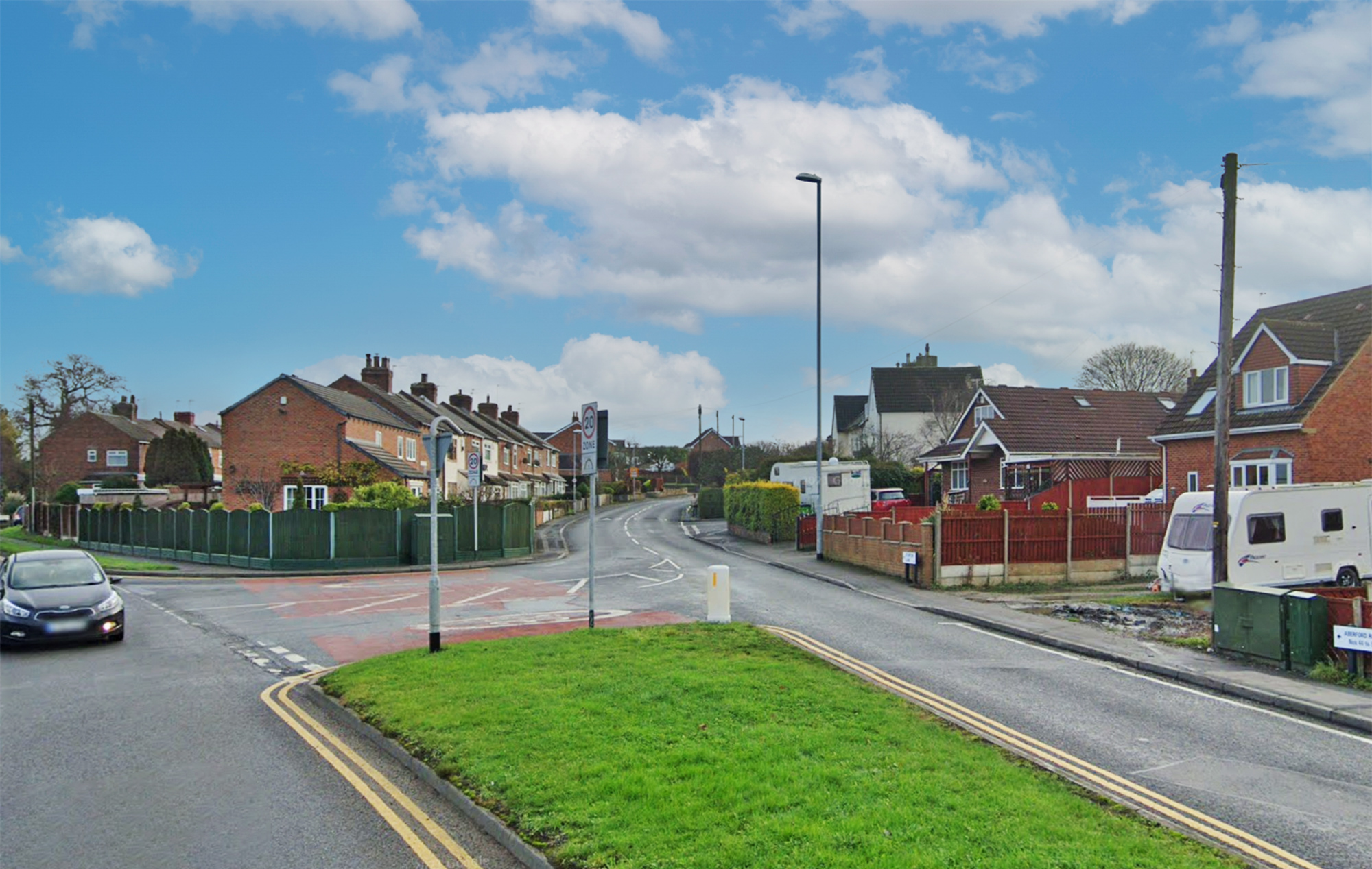
Here we travel up Aberford Road from where it begins at Town End at the top of Main Street out towards East Garforth. Aberford Road bounds the North side of Garforth and includes many old buildings and houses as well as Garforth Station.
The road was originally a toll road with the toll house being where Toll Bar Garage now stands at the end of Bar Lane. This road is of course far busier than it ever was years ago as it servers as the main access route into the newer East Garforth housing estates around Sturton Lane and beyond.
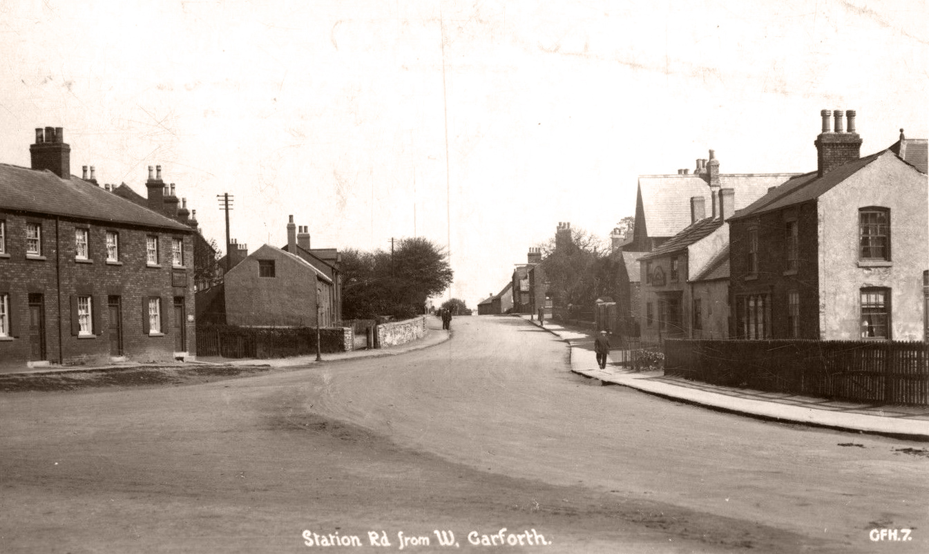
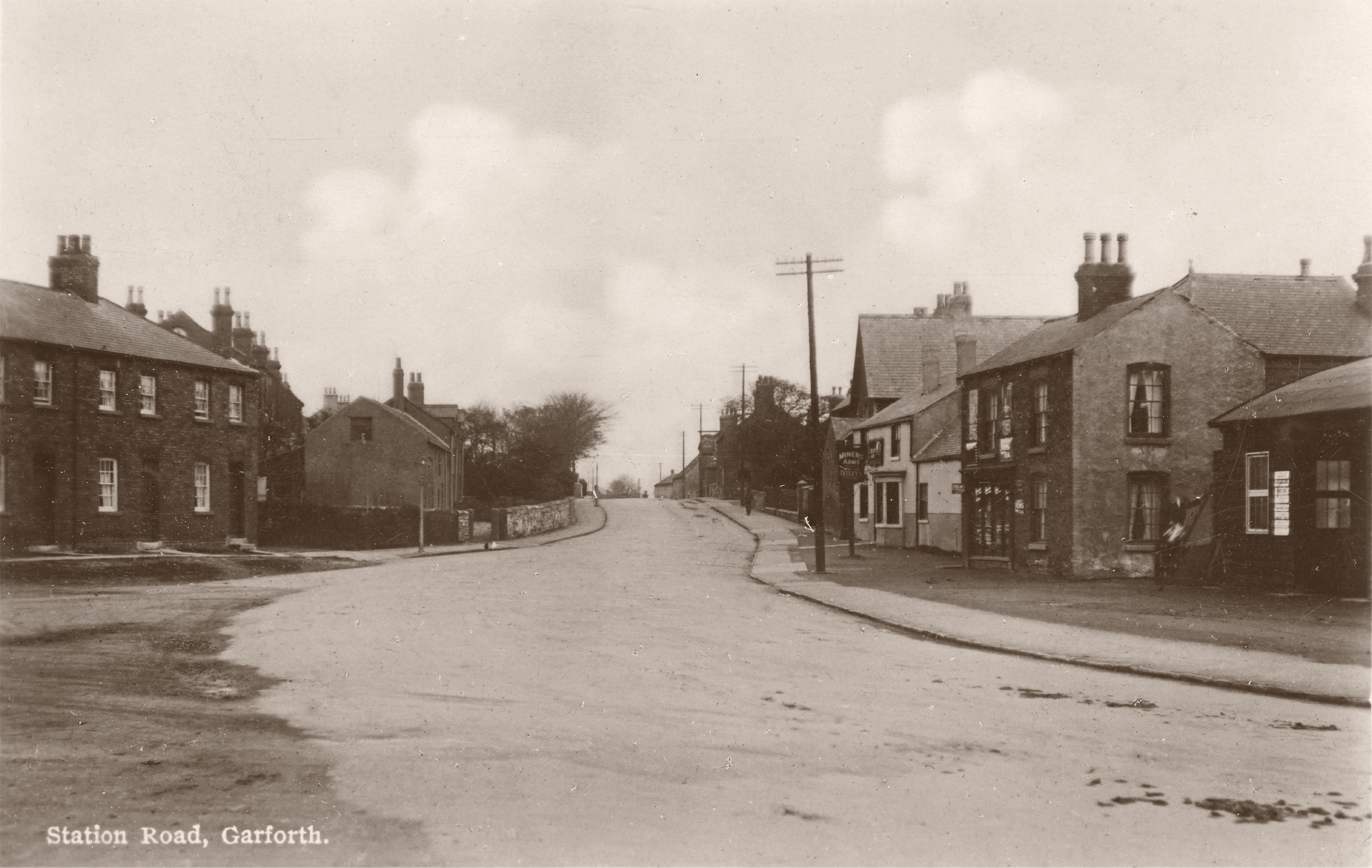
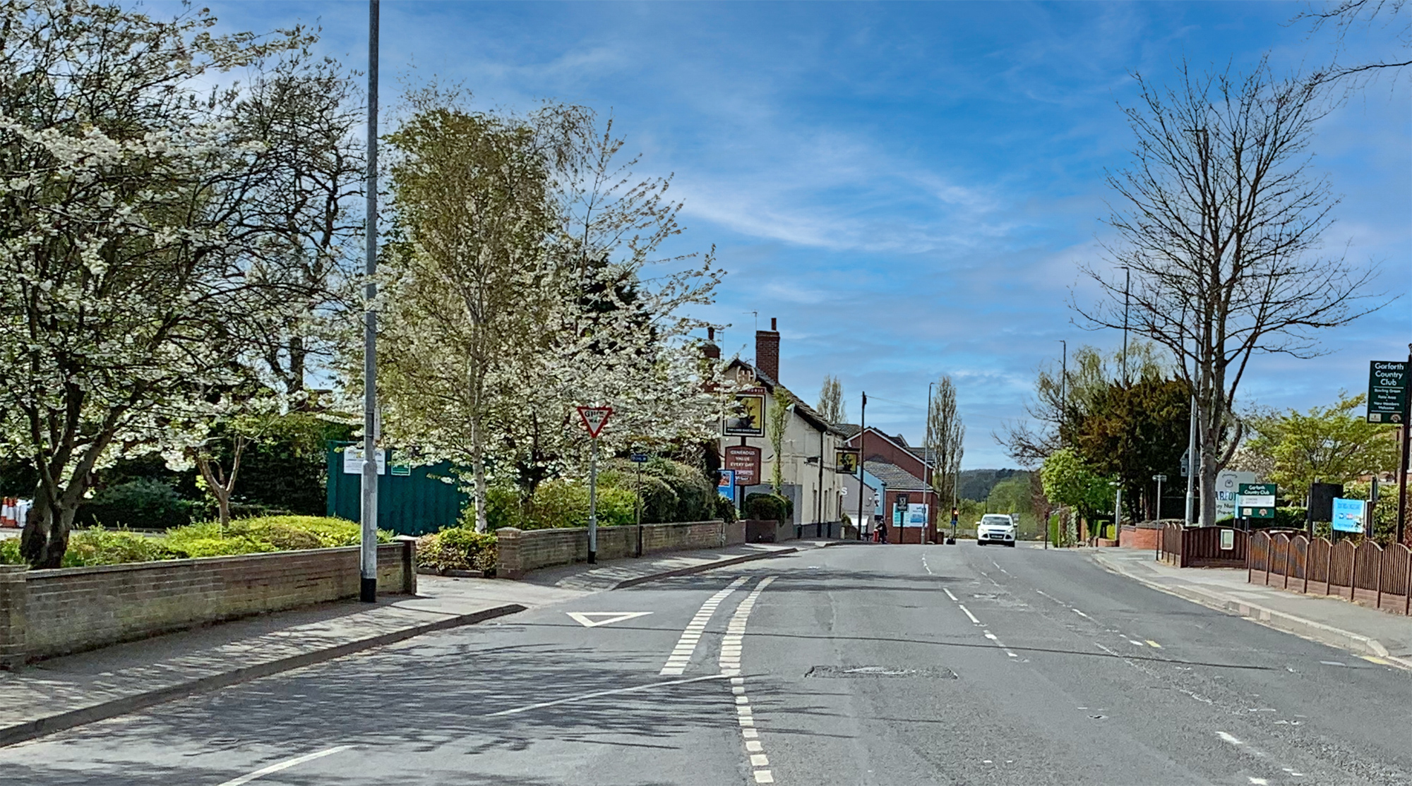
The road was also called 'Station Road' historically as can be seen on some of the old postcards below. Now Station Road just refers to the short piece of road leading down to the station from where you turn off the Aberford Road.
The station itself has its own page of photos.
Town End (Towards Briggate and Wakefield Road)

- date
- c.1910
- copyright
- Bramley
- full size
- 2000x1231px
- postcard
- Bramley B10
- date
- March 2019
- copyright
- Ian Atkinson
- full size
- 2000x1371px
- date
- Unknown
- copyright
- Parkinson and Roy
- full size
- 1035x566px
- postcard
- Parkinsonandroy NN13
The shop next to the butchers with the board mounted on the front was Frank Ashton’s chemists [2].
- date
- c.1910
- copyright
- Bramley
- full size
- 1352x825px
- postcard
- Bramley NN14
- date
- April 2021
- copyright
- Ian Atkinson
- full size
- 2000x1222px
- status
- temporary image
Looking down Wakefield Road with the top of Main Street on the left. The corner property was a butcher’s shop owned by Squire Backhouse [3].
- date
- Unknown
- copyright
- Bramley
- full size
- 1546x953px
- postcard
- Bramley NN18
- date
- August 2007
- copyright
- Ian Atkinson
- full size
- 2000x1133px
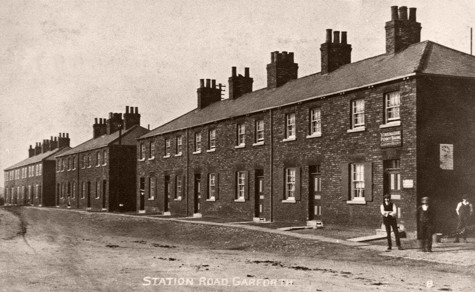
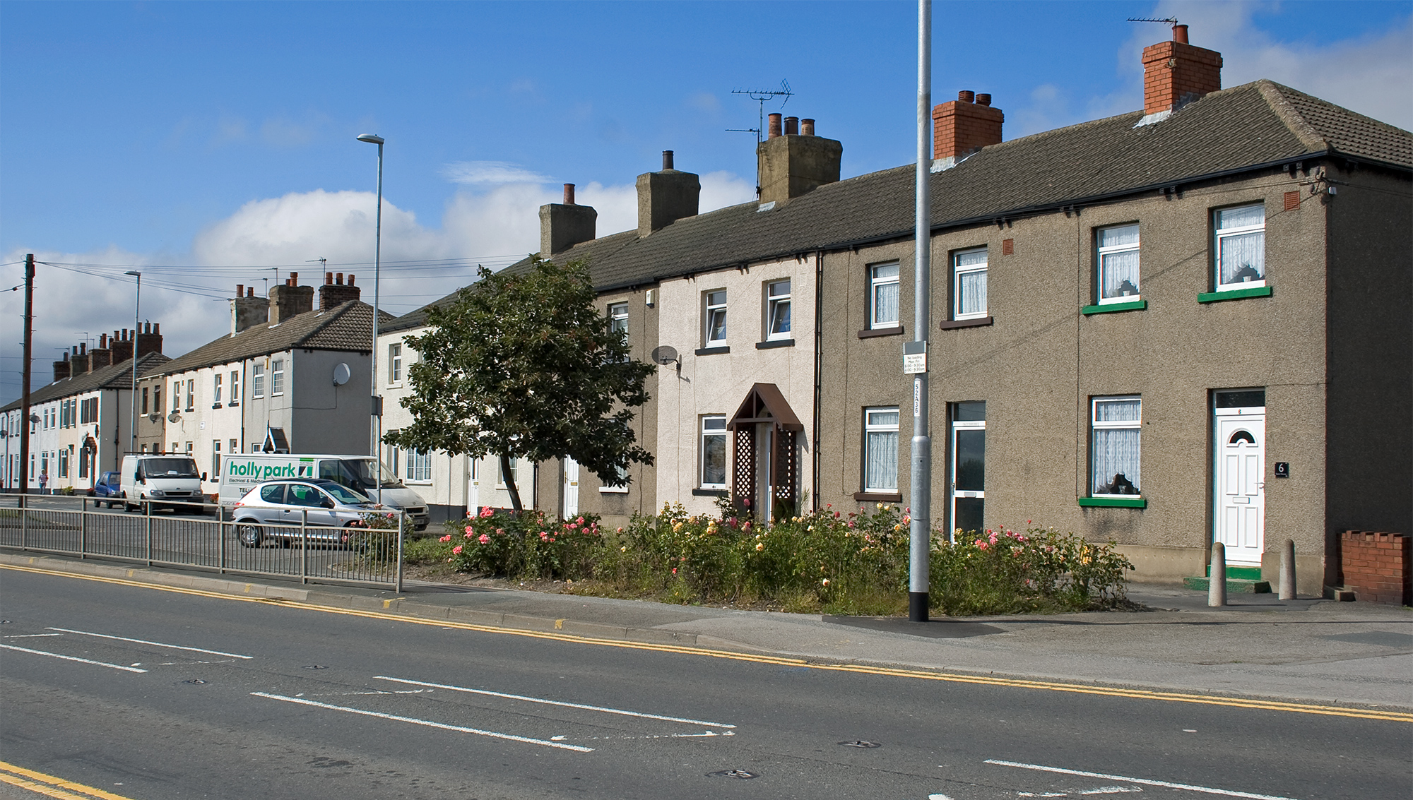
This image shows the row of houses at Town End, which is little changed today. The closest house in the right of the frame was used by the Yorkshire Penny Bank and the house is still called ‘Bank House’ today. The house was owned by Mr. and Mrs. Dixon who rented a room to the bank every other Saturday evening. The bank was operated by Ben Chadwick who was the headmaster of the Colliery School at East Gaforth [2].
Town End (Towards Aberford)
- date
- c.1913
- copyright
- Laycocks
- full size
- 2000x1215px
- postcard
- Laycocks 0491
- date
- March 2019
- copyright
- Ian Atkinson
- full size
- 2000x1236px
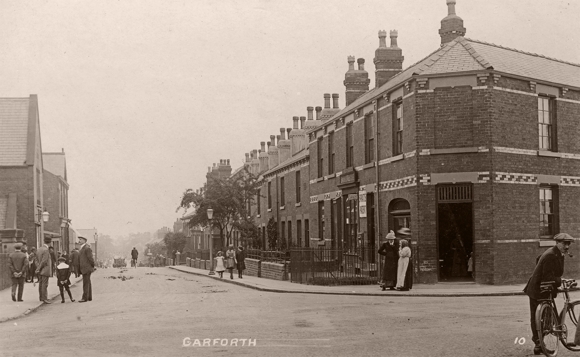
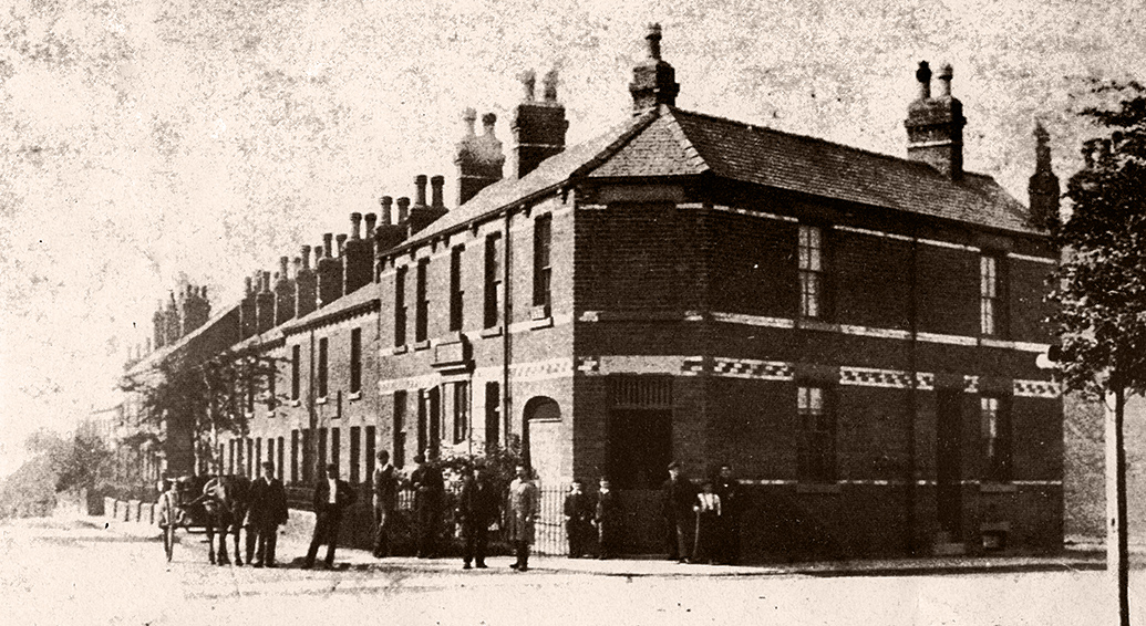
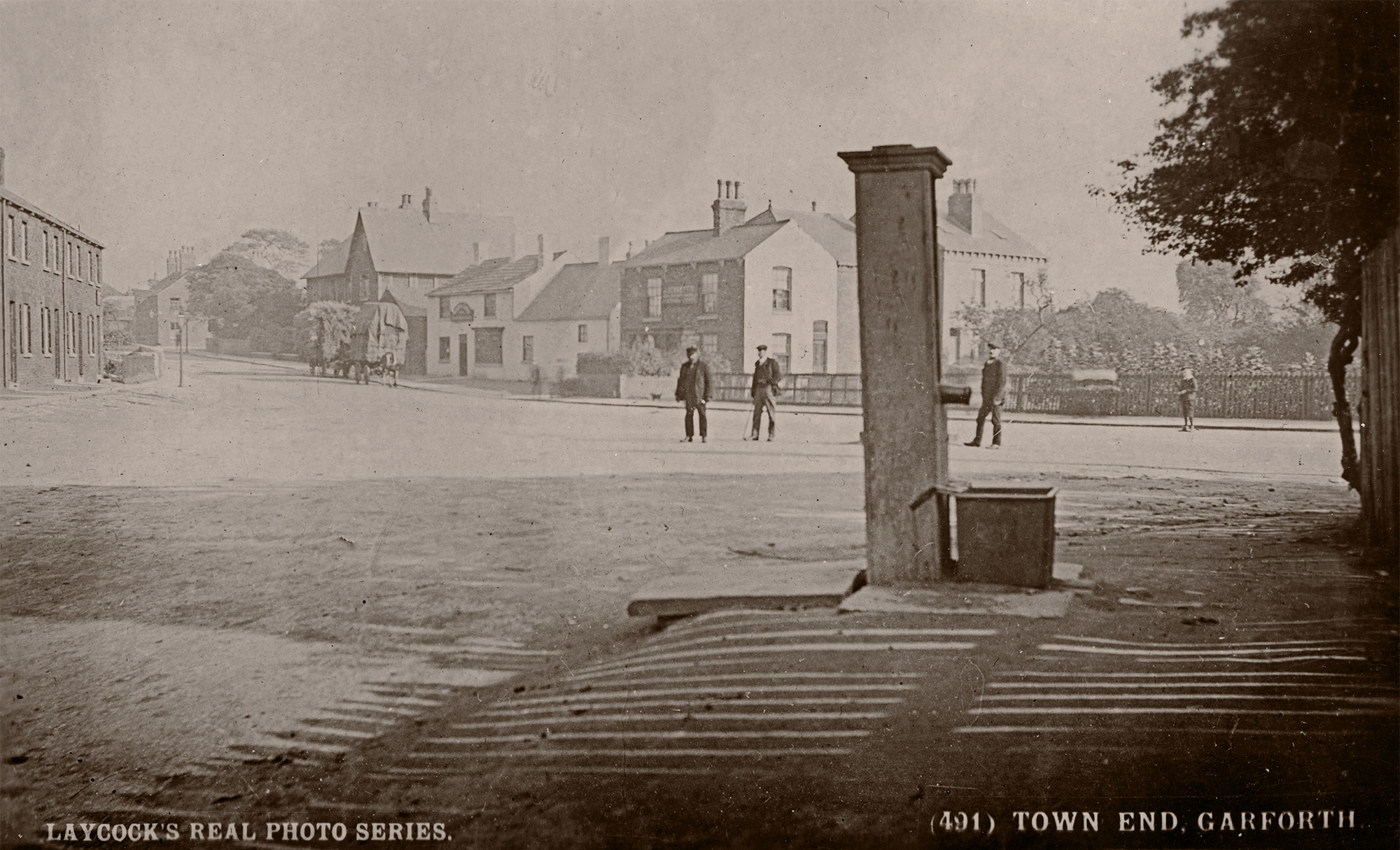
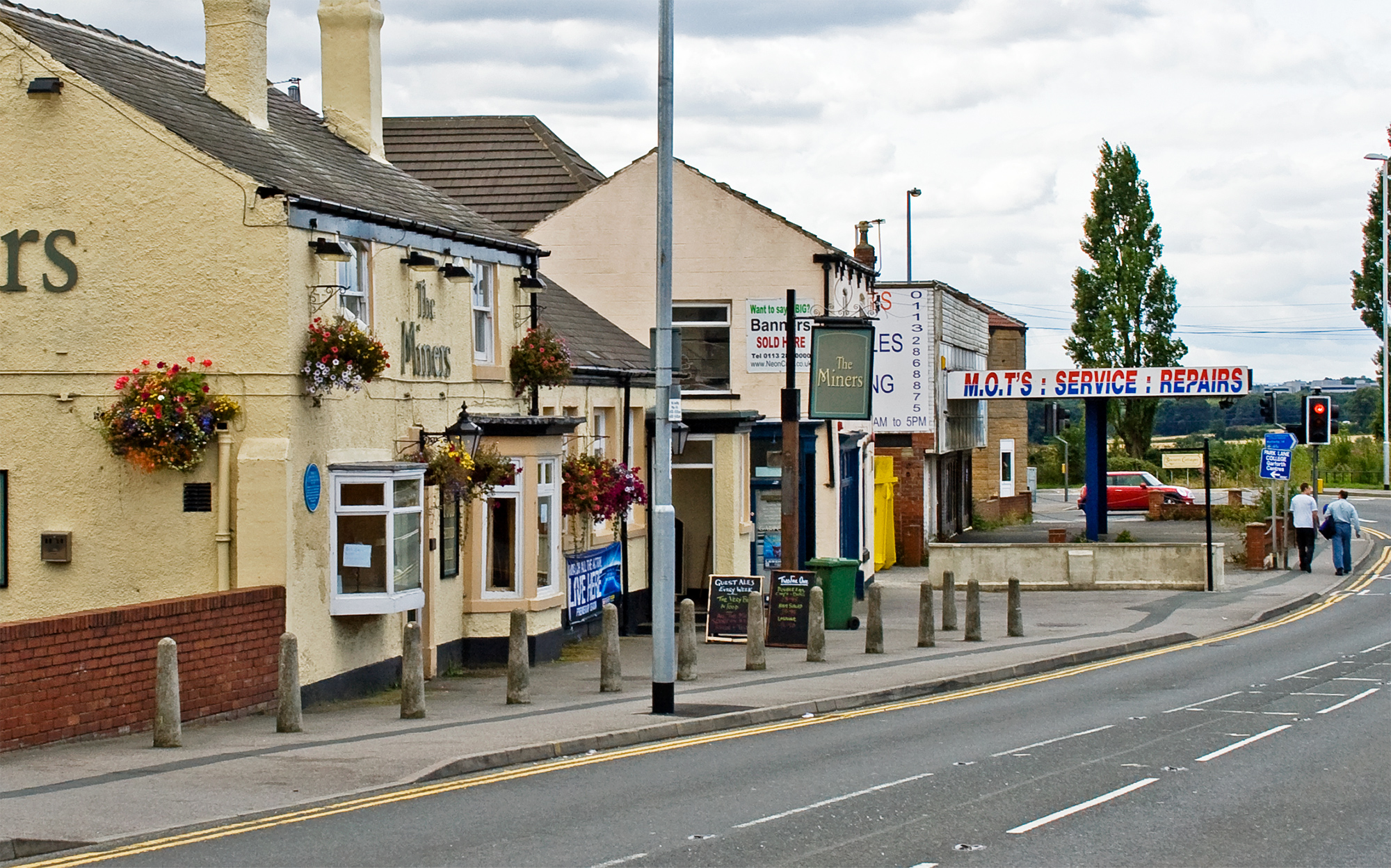
Looking towards The Miner’s Arms and Aberford Road from Town End. The large gabled house that can be seen in this first image past the Miner’s belonged to Tom Pickering and was demolished c.1938 to make way for Oak Road [3].

- date
- c.1910
- copyright
- Bramley
- full size
- 2000x1223px
- postcard
- Bramley B14
- date
- August 2007
- copyright
- Ian Atkinson
- full size
- 2000x1346px
- date
- 1925
- copyright
- Unknown
- full size
- 500x336px
- date
- April 2021
- copyright
- Ian Atkinson
- full size
- 2000x1397px
- status
- temporary image
- date
- Unknown
- copyright
- Bramley
- full size
- 790x465px
- postcard
- Bramley B02
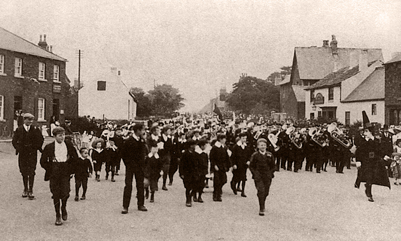
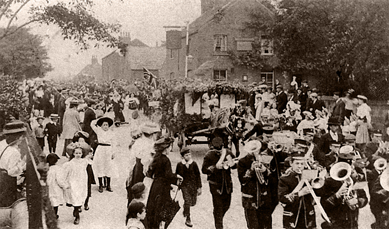
A carnival taking place in Aberford Road during Edwardian times with The Gascoignes in the background [3].
- date
- Unknown
- copyright
- Unknown
- full size
- 1504x945px
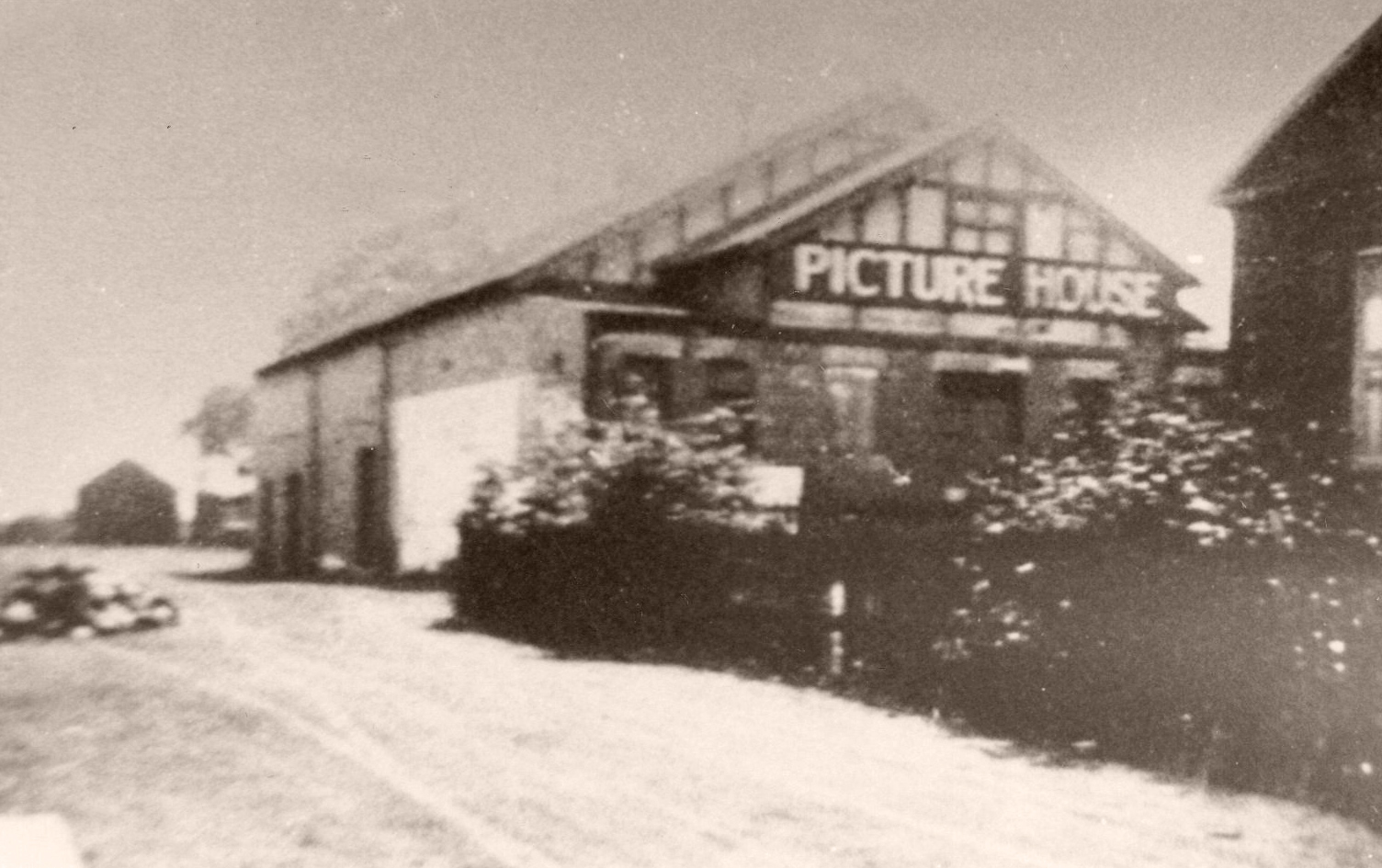
Garforth Cinema which was located near The Miners Arms at Town End [3].
The Gascoigne Arms

- date
- c.1960
- copyright
- Unknown
- full size
- 789x486px
- date
- August 2007
- copyright
- Ian Atkinson
- full size
- 2000x1247px
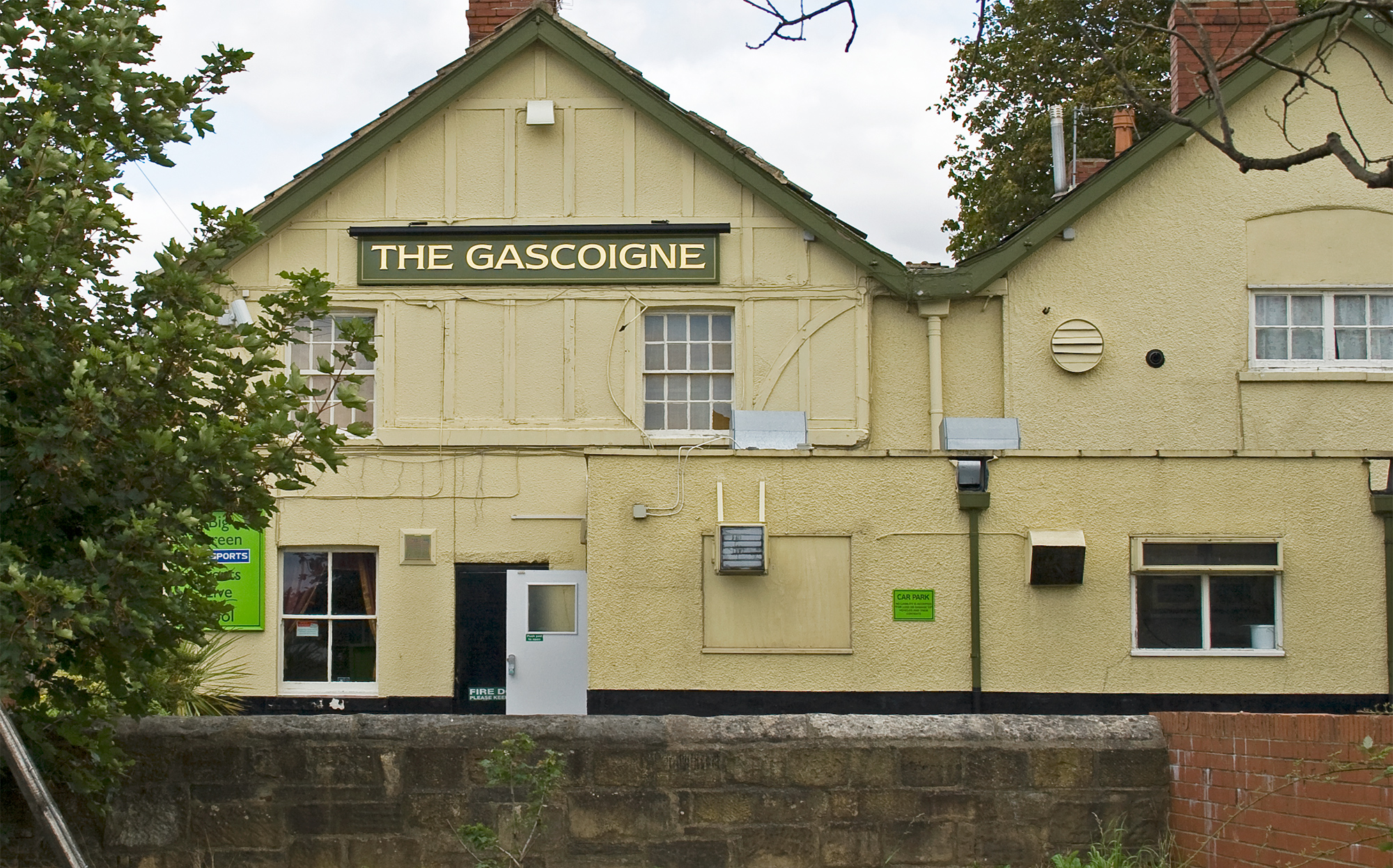
The Gascoigne Arms which at the time was selling Bentley’s Yorkshire Bitter, brewed in Woodlesford [3].
The Miners Arms
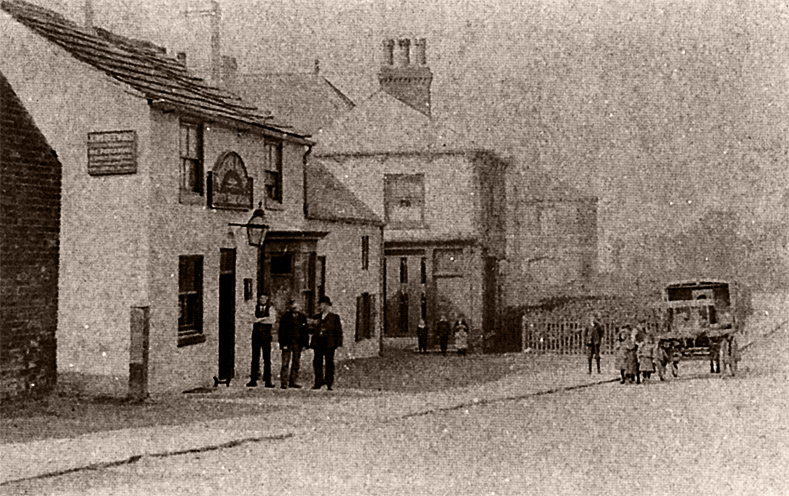
The Miners was previously known as ‘The Jolly Collier’, ‘Vince’s’ and also ‘The Black Bull’ [3].
- date
- Unknown
- copyright
- Unknown
- full size
- 789x496px
- date
- August 2007
- copyright
- Ian Atkinson
- full size
- 2000x1248px
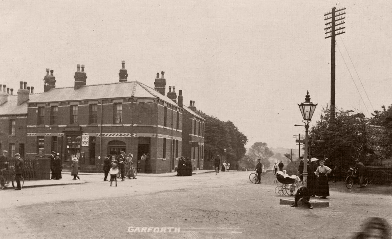
Aberford Road General

- date
- Unknown
- copyright
- Unknown
- full size
- 789x475px
These old mill buildings were situated where Beaconsfield House now stands. Whilst originally a flour mill, they were used as a grass mill during WW2 and finally as a council depot [3].

- date
- unknown
- copyright
- Phototype Co.
- full size
- 2000x1271px
- postcard
- Phototype 1888
Old cottages opposite the Gascoigne pub with Salisbury Terrace above.

- date
- Unknown
- copyright
- Laycocks
- full size
- 1861x1159px
- postcard
- Laycocks 0500
- date
- April 2021
- copyright
- Ian Atkinson
- full size
- 2000x1245px
- status
- temporary image
Salisbury Terrace on the left with the Gascoigne on the right.

- date
- Unknown
- copyright
- Bramley
- full size
- 500x308px
- postcard
- Bramley NN17
- date
- March 2019
- copyright
- Ian Atkinson
- full size
- 2000x1418px
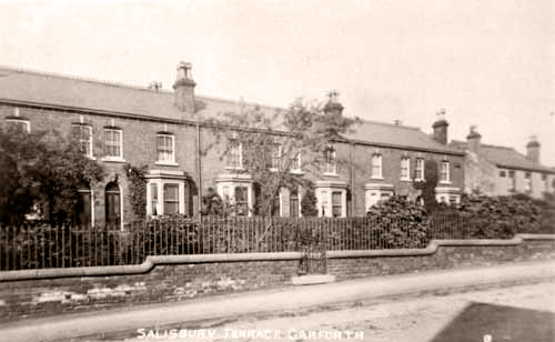
The row of houses opposite the Gascoigne knows as Salisbury Terrace.

- date
- c.1925
- copyright
- Parkinson and Roy
- full size
- 368x234px
- postcard
- Parkinsonandroy 390
- date
- March 2019
- copyright
- Ian Atkinson
- full size
- 2000x1275px
Salisbury Terrace on the right with the Gascoigne on the left.
- date
- c.1910
- copyright
- Parkinson and Roy
- full size
- 1549x959px
- postcard
- Parkinsonandroy NN02
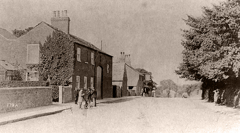
Salisbury Terrace on the right with the Gascoigne on the left.
- date
- Unknown
- copyright
- Parkinson and Roy
- full size
- 790x440px
- postcard
- Parkinsonandroy 179A
- date
- April 2021
- copyright
- Ian Atkinson
- full size
- 2000x1114px
- status
- temporary image
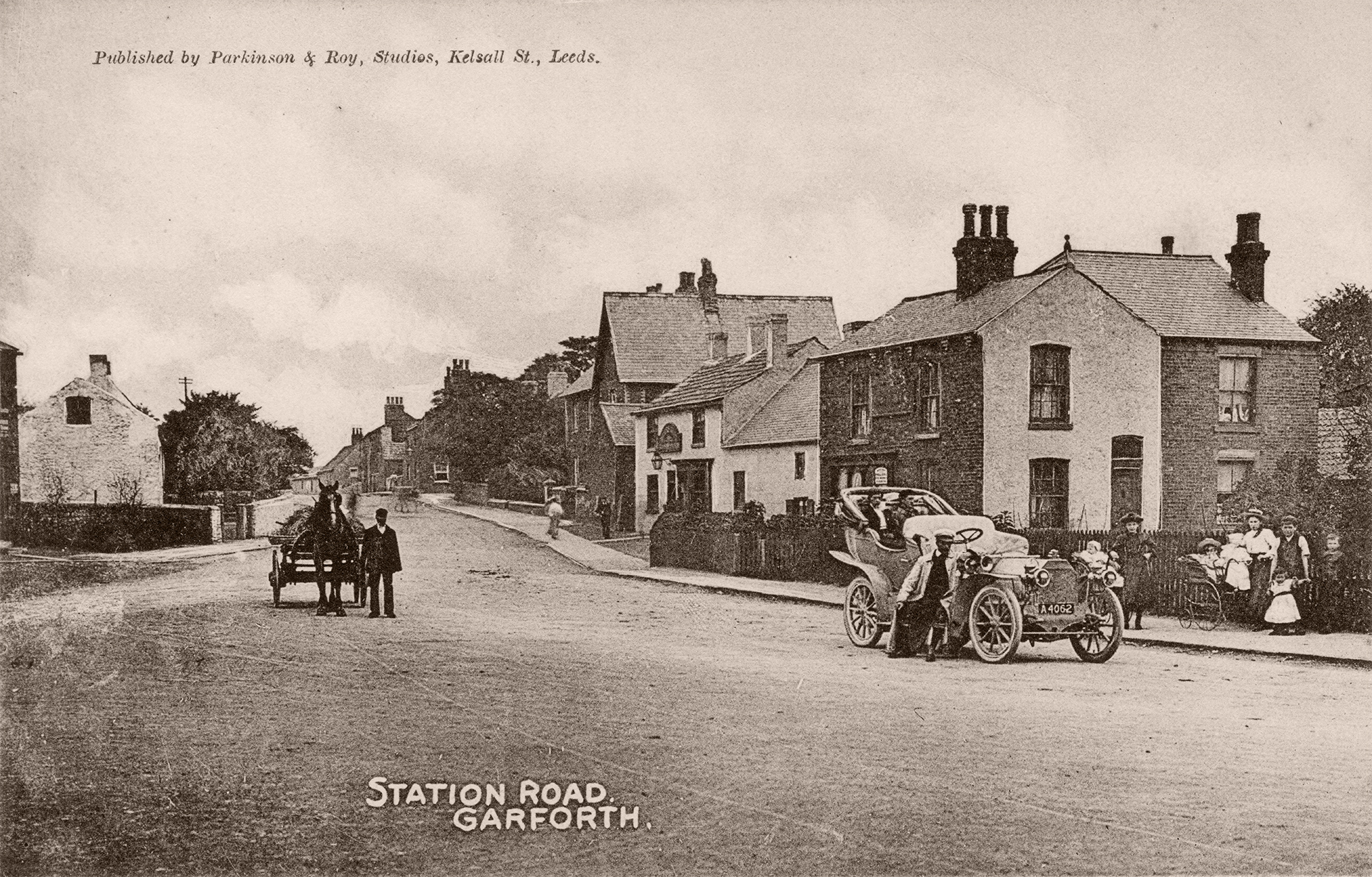
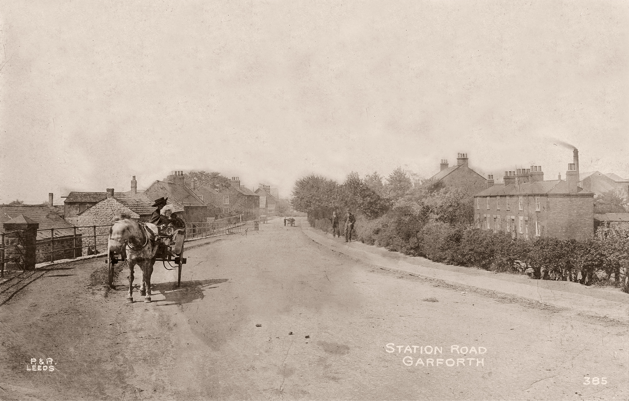
Green’s nurseries in Aberford Road which stood where St Benedict’s now stands [3]. The building with the sign hanging on a pole further down the Road is The Gascoignes.
- date
- c.1905
- copyright
- Parkinson and Roy
- full size
- 2000x1274px
- postcard
- Parkinsonandroy 385
- date
- March 2019
- copyright
- Ian Atkinson
- full size
- 2000x1498px
- status
- temporary image
Towards Town End from the railway bridge.

- date
- Unknown
- copyright
- Unknown
- full size
- 789x454px
- date
- August 2007
- copyright
- Ian Atkinson
- full size
- 2000x1256px
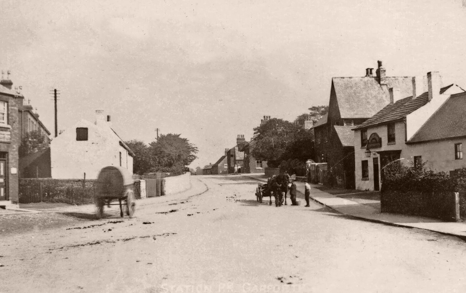
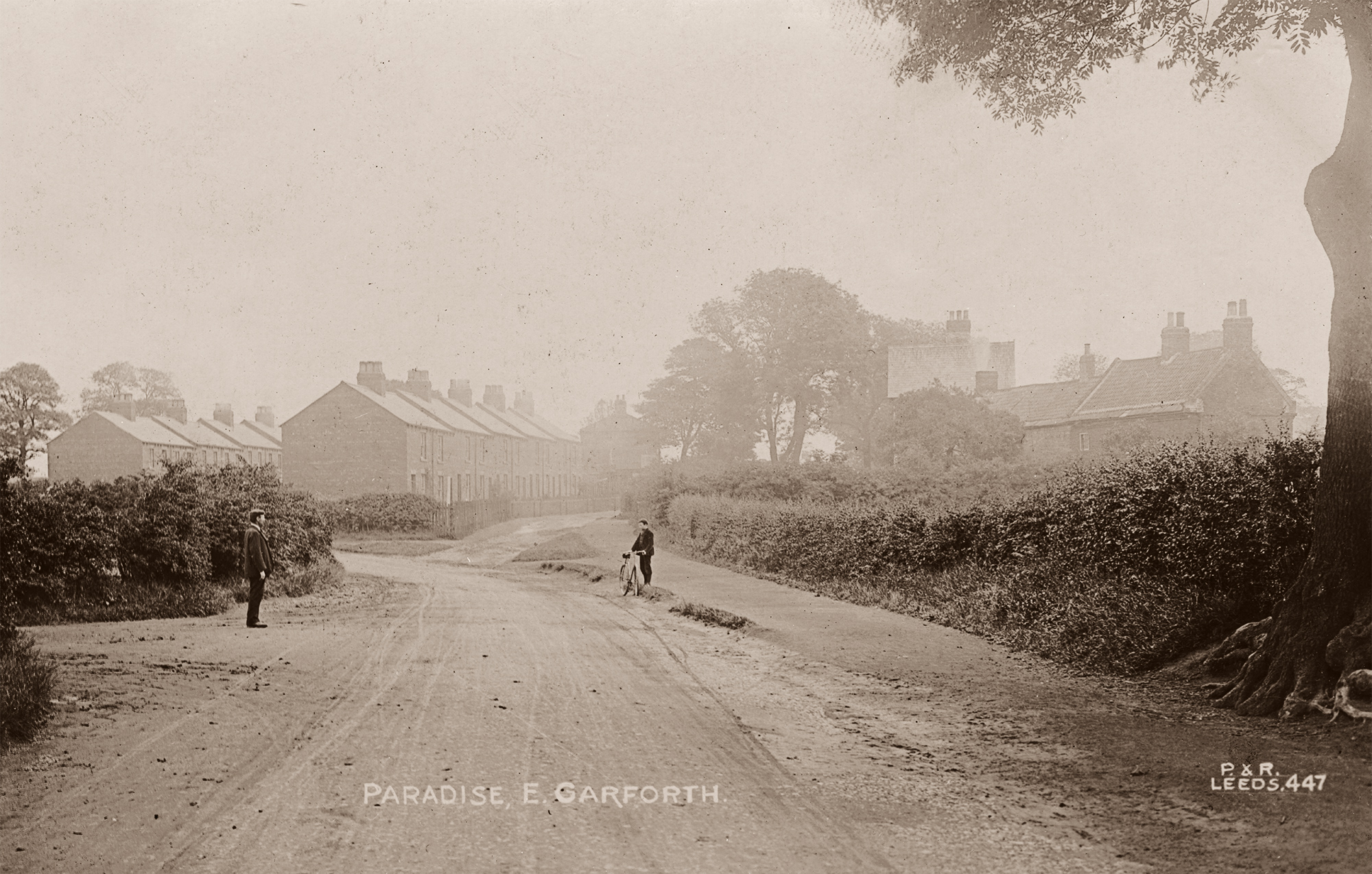
The end of Bar Lane and is looking towards Aberford. Toll Bar House can be seen on the left and the Colliery School and Paradise are in the distance.
The field on the right is where Greens nurseries grew their trees and shrubs [3].
Station Road

- date
- Unknown
- copyright
- Unknown
- full size
- 758x492px
- date
- August 2007
- copyright
- Ian Atkinson
- full size
- 2000x1376px
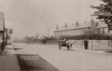
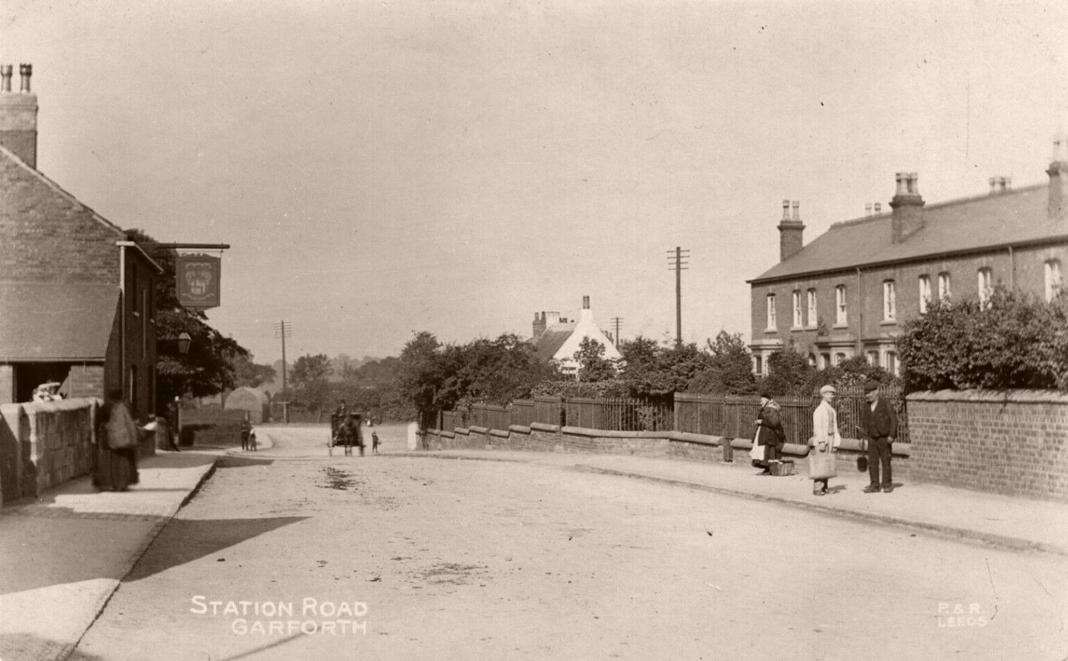
This is an view of Station Road looking towards Aberford Road and shows pigs about to be taken to the market by rail [3].
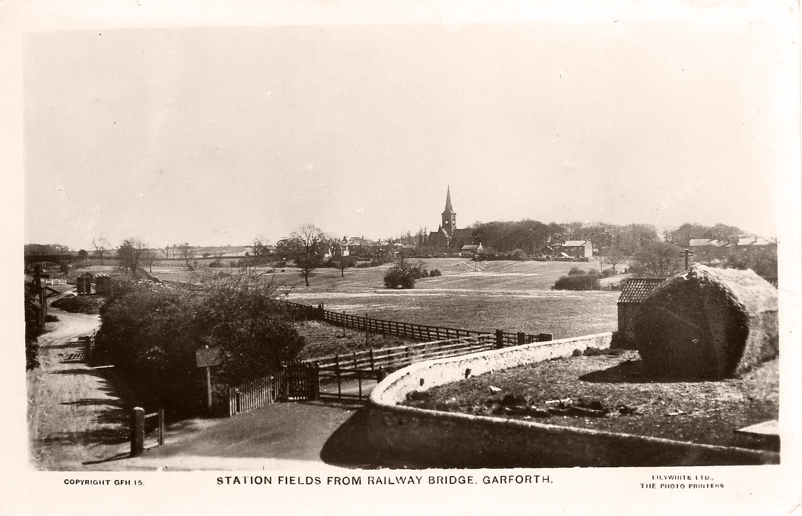
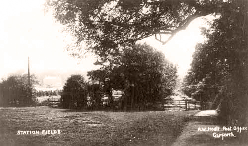
Station Fields
- date
- c.1915
- copyright
- Lilywhite
- full size
- 790x450px
- postcard
- Lilywhite GFH15
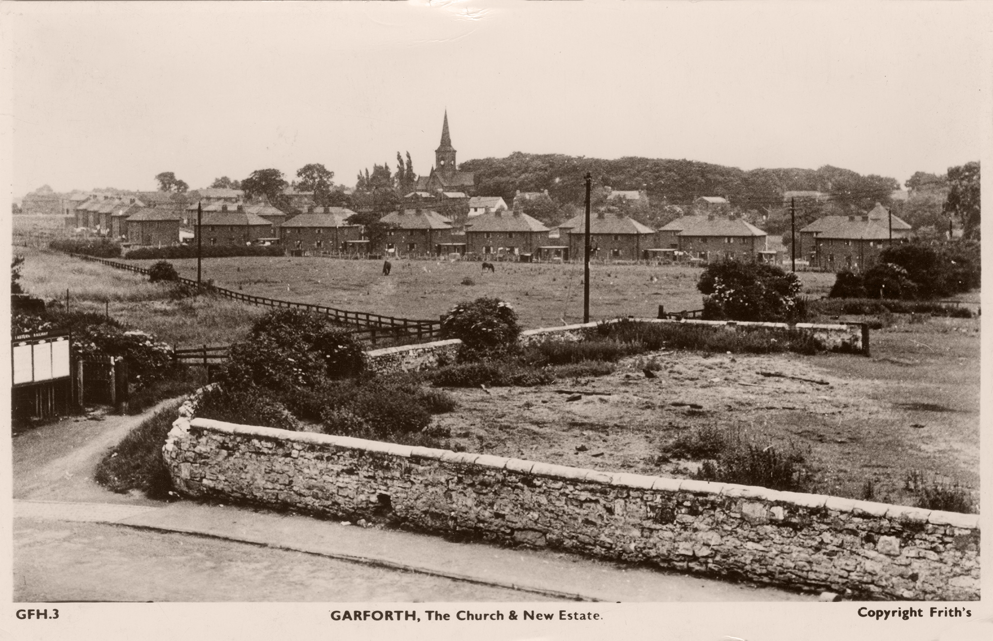
This image is looking from the station across Station Fields towards Church Lane. This is where the Oak Estate now stands.
- date
- c.1951
- copyright
- The Francis Frith Collection
- full size
- 2000x1292px
- postcard
- Frith GFH03
- date
- March 2019
- copyright
- Ian Atkinson
- full size
- 2000x1171px
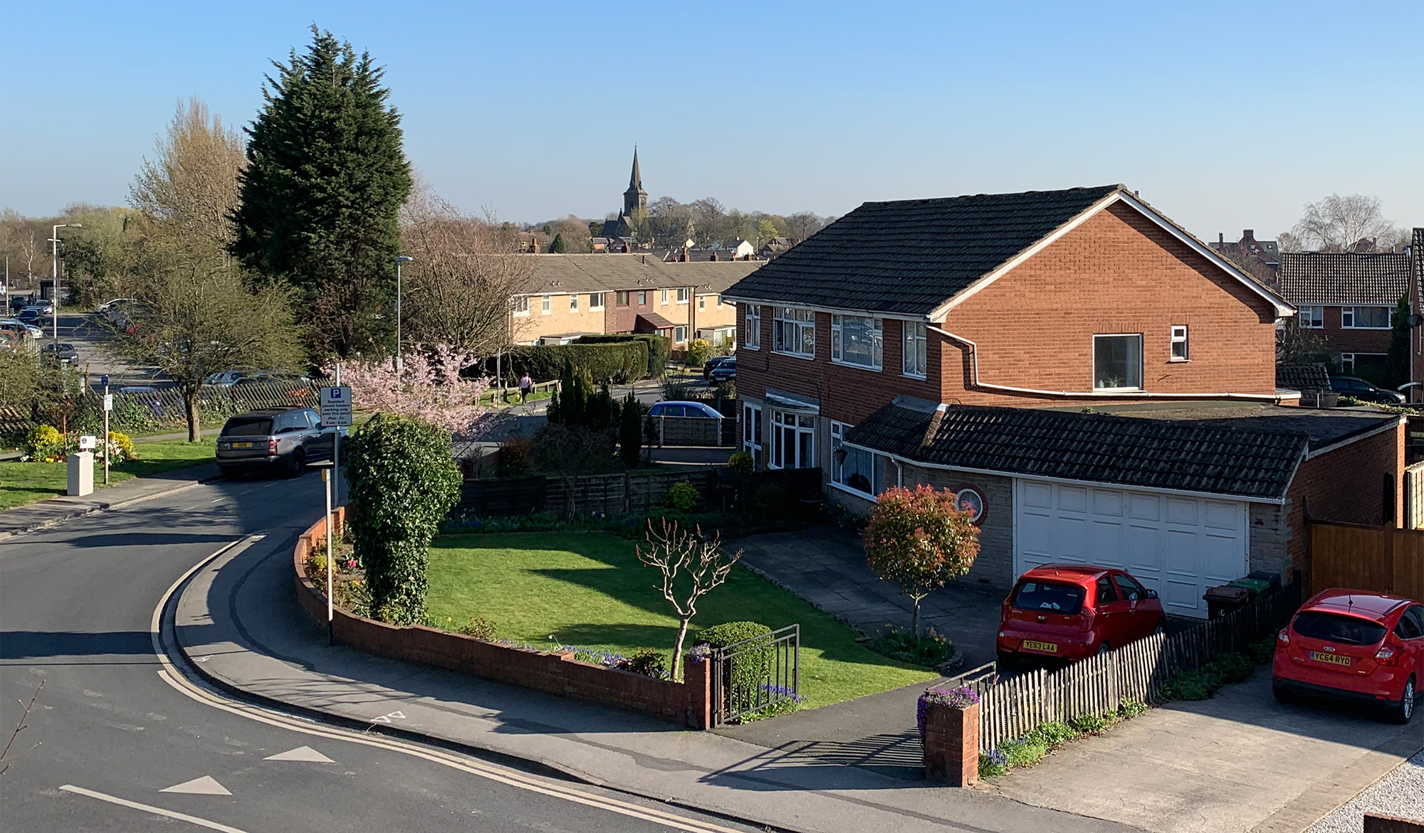
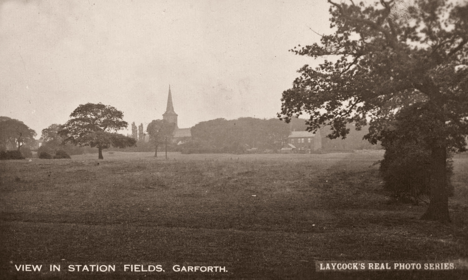
A similar view of Station Fields the Lilywhite GFH15 card but taken years later. Here you can see that more of the Oak Estate has been built but there is still some field left.

- date
- Unknown
- copyright
- Lilywhite
- full size
- 739x413px
- postcard
- Lilywhite GFH03
- date
- March 2019
- copyright
- Ian Atkinson
- full size
- 2000x1168px
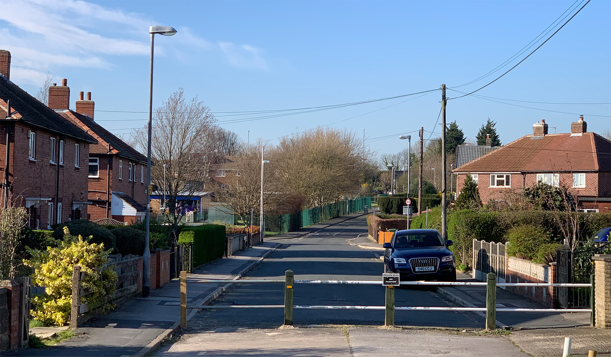
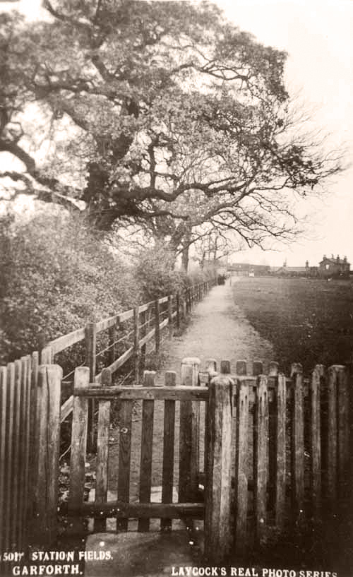
This image looks down the lane that has now become Station Fields, formerly called Station Avenue.
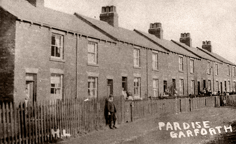
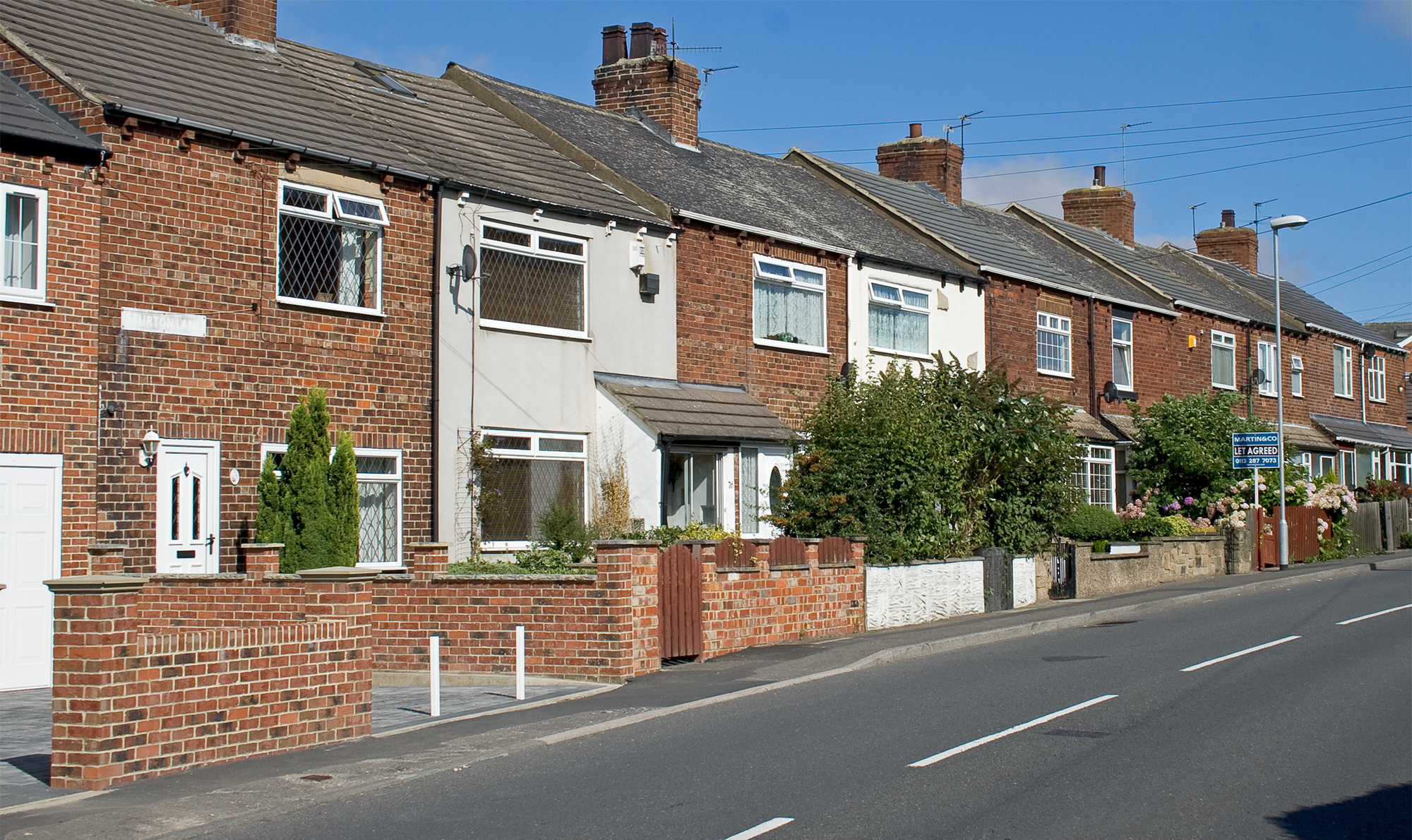
Sturton Lane
These are images of ‘Paradise’, now known as Sturton Lane.
- date
- unknown
- copyright
- Parkinson and Roy
- full size
- 2000x1275px
- postcard
- Parkinsonandroy 447
- date
- December 2020
- copyright
- full size
- 2000x1268px
- date
- Unknown
- copyright
- Unknown
- full size
- 789x484px
- date
- August 2007
- copyright
- Ian Atkinson
- full size
- 2000x1190px


- date
- c.1900
- copyright
- Phototype Co.
- full size
- 789x450px
- postcard
- Phototype 1868
- date
- April 2021
- copyright
- Ian Atkinson
- full size
- 2000x1253px
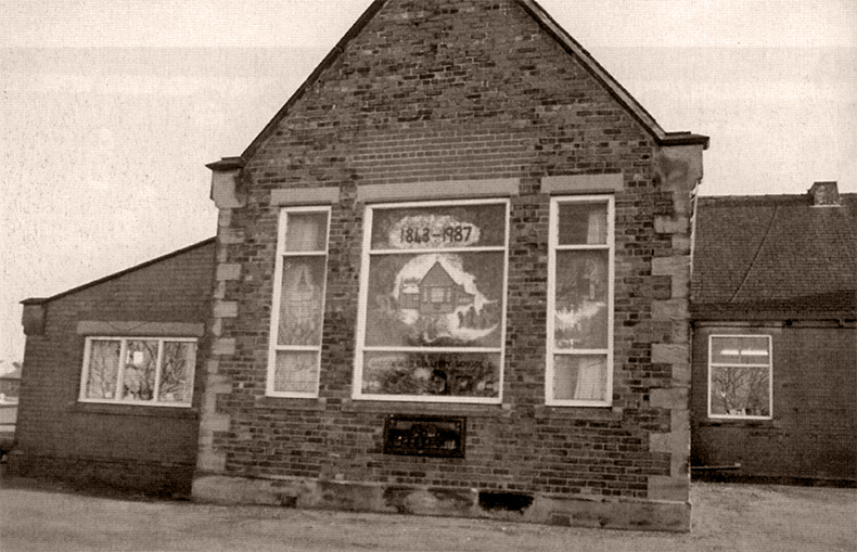
East Garforth School
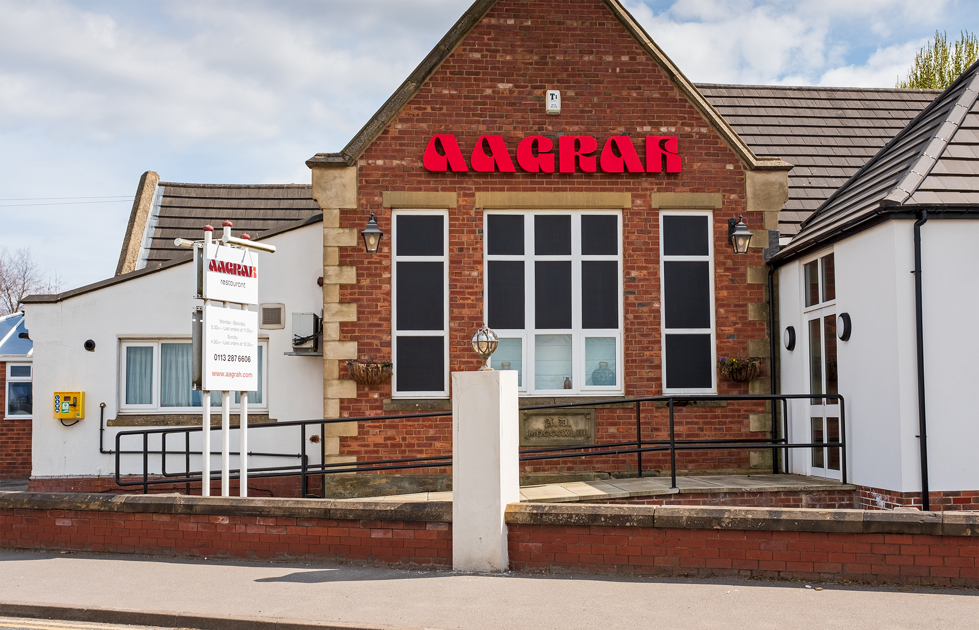
East Garforth School, formerly known as the Colliery School, was built in 1843 by the Gascoigne family in order to provide an education for the children of the colliers. It was finally closed down and moved to new premises close by in 1987 and the building is now the Aagrah Indian Restaurant [3].
- date
- 1987
- copyright
- Unknown
- full size
- 790x509px
- date
- April 2021
- copyright
- Ian Atkinson
- full size
- 2000x1287px

- date
- Unknown
- copyright
- Phototype Co.
- full size
- 500x320px
- postcard
- Phototype NN02
This view is also taken from Aberford Road at an earlier time. As seen above the entry porch and round window have been removed in the past and various extensions added. The date stone (AD MDCCCXLIII for 1843) has been removed from above the porch and re-set lower down in the wall, the bricks are visibly different in the later photo showing where it was.