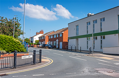
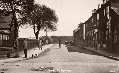
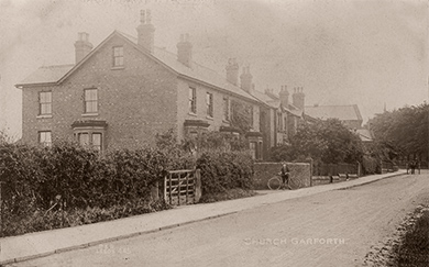
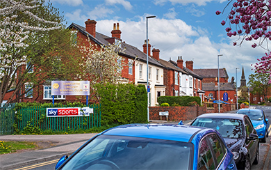
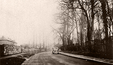
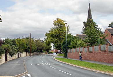
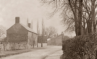
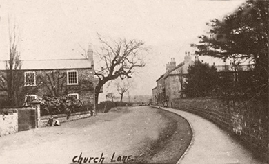
Here we follow Church Lane from its starting point near the bottom of Main Street until it meets Ninelands Lane at the top end. Running East-West through what was historically known as Church Garforth, Church Lane contains a mixture of newer houses as well older houses and of course two churches.
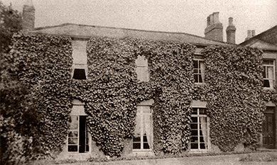
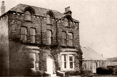
Sadly many older and grand houses such as The Grange and Rose Villa as can be seen below were demolished years ago to make way for the Grange estate which went up around the 1960s.
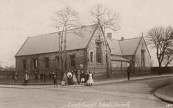
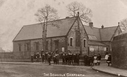
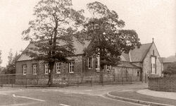
The Parochial School
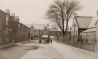
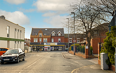
These images show the Parochial School which stood at the end of Church Lane opposite the Library. The school was closed in 1990 and demolished in 1994 where the medical centre was built in its place. I remember the school standing empty when I was younger, I never went inside as I was at Barleyhill Infants School and then West Garforth Junior School and I don't think I've ever seen a photo of the interior either.
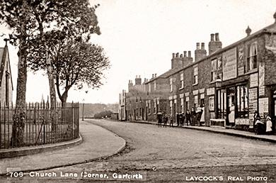
Church Lane Corner
- date
- Unknown
- copyright
- Unknown
- full size
- 769x486px
This parade of shops stood where the Library now stands and included Varley’s Hairdressers, Laycock’s newsagents and Shackleton’s bakery [3].
- date
- Unknown
- copyright
- Unknown
- full size
- 500x333px
Shackleton's Bakery which was situated where Garforth Library now stands.
- date
- Unknown
- copyright
- Laycocks
- full size
- 829x549px
- postcard
- Laycocks 0706
- date
- May 2021
- copyright
- Ian Atkinson
- full size
- 2000x1307px
- date
- c1900
- copyright
- Unknown
- full size
- 500x264px
- date
- Unknown
- copyright
- Lilywhite
- full size
- 1704x1054px
- postcard
- Lilywhite GFH09
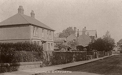
The bottom of Church Lane with the Parochial School on the left hand side.
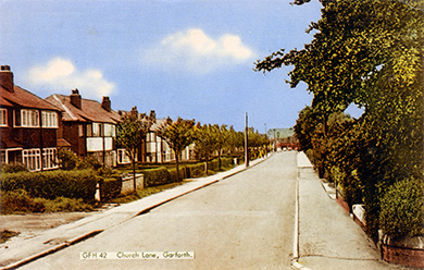
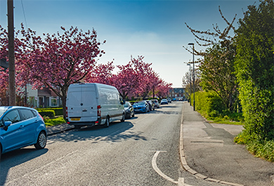
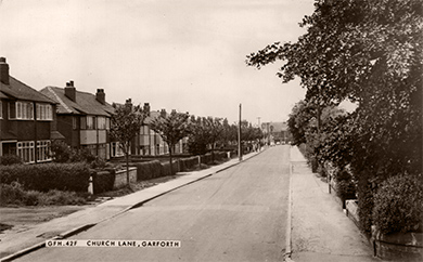
Church Lane Lower
- date
- c.1906
- copyright
- Bramley
- full size
- 2000x1214px
- postcard
- Bramley B36
- date
- March 2019
- copyright
- Ian Atkinson
- full size
- 2000x1270px
- date
- c.1969
- copyright
- The Francis Frith Collection
- full size
- 2000x1273px
- postcard
- Frith GFH42
- date
- April 2019
- copyright
- Ian Atkinson
- full size
- 2000x1353px
- date
- c.1969
- copyright
- The Francis Frith Collection
- full size
- 2000x1240px
- postcard
- Frith GFH42F
- date
- c.1920
- copyright
- Lilywhite
- full size
- 2000x1276px
- postcard
- Lilywhite GFH05
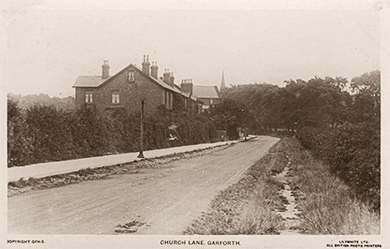
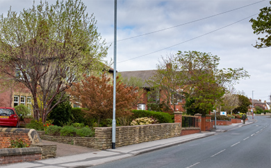
The cricket ground is on the left hand side behind the hedge.
- date
- c.1905
- copyright
- Parkinson and Roy
- full size
- 2000x1248px
- postcard
- Parkinsonandroy 445
- date
- April 2020
- copyright
- Ian Atkinson
- full size
- 2000x1251px
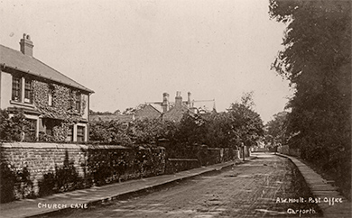
The cricket ground is on the left hand side behind the hedge and the methodist church is on the right with St. Mary's further in the distance.
The Grange
The Grange was a large house which stood on Church Lane. The house was demolished in order to make way for the Grange estate, which was of course named after the house [3].
- date
- Unknown
- copyright
- Laycocks
- full size
- 500x330px
- postcard
- Laycocks NN04
The Hollies
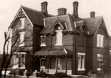
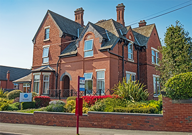
The Hollies was built in Church Lane by a man named Jabez Wooley who owned a brickworks in Leeds [3]. The Hollies is now a home for the elderly but still retains its original name.
- date
- Unknown
- copyright
- Unknown
- full size
- 710x498px
- date
- April 2019
- copyright
- Ian Atkinson
- full size
- 2000x1409px
Church Lane Upper
- date
- c.1912
- copyright
- Bramley
- full size
- 2000x1240px
- postcard
- Bramley B29
- date
- April 2020
- copyright
- Ian Atkinson
- full size
- 2000x1244px
Numbers 21 to 27 between the methodist thurch and the Hollies
- date
- c.1924
- copyright
- Hoult
- full size
- 2000x1240px
- postcard
- Hoult NN02
An almost identical view to the Bramley B29 card.
- date
- c.1904
- copyright
- Parkinson and Roy
- full size
- 2000x1292px
- postcard
- Parkinsonandroy NN16
- date
- April 2020
- copyright
- Ian Atkinson
- full size
- 2000x1292px
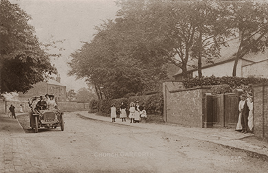
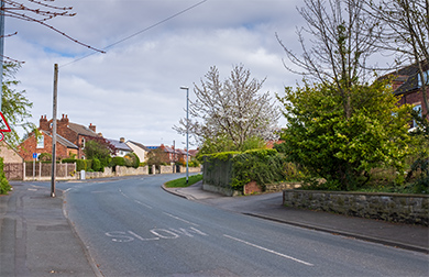
Near Station Fields showing the tradesmans’ entrance to The Grange in the right of the frame [2].
- date
- c.1980s
- copyright
- Unknown
- full size
- 789x498px
- date
- March 2019
- copyright
- Ian Atkinson
- full size
- 2000x1239px
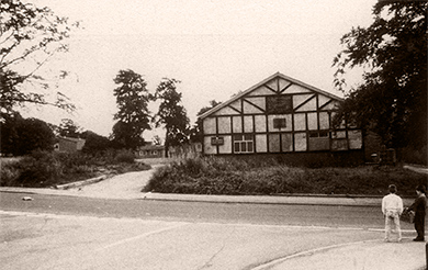
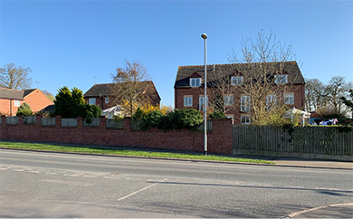
St. Mary’s church hall, which burnt down in the 1990s. The huts used by the Scouts and the Girl Guides can be seen in the background amongst the trees.
This whole area was flattened in order to build The Mead cul-de-sac.
- date
- 1930s
- copyright
- Richards
- full size
- 788x453px
- postcard
- Richards 08
- date
- August 2007
- copyright
- Ian Atkinson
- full size
- 2000x1360px
- status
- temporary image
A view from the 1930s with St Mary’s behind the trees.
- date
- c.1910
- copyright
- Bramley
- full size
- 2000x1232px
- postcard
- Bramley NN05
The church grounds are on the right hand side and the cottages on the left were demolished in order to make way for Oak Crescent [3].
- date
- c.1909
- copyright
- Phototype Co.
- full size
- 2000x1226px
- postcard
- Phototype NN06
- date
- May 2021
- copyright
- Ian Atkinson
- full size
- 2000x1227px
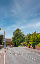
Looking towards Nineland Lane with the church wall on the right.
- date
- c.1905
- copyright
- Parkinson and Roy
- full size
- 820x1300px
- postcard
- Parkinsonandroy 040
- date
- May 2021
- copyright
- Ian Atkinson
- full size
- 824x1300px
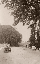
Looking down Church Lane with the church wall on the left. The car with registration A4062 appears in quite a few of the Parkinson and Roy cards, I suspect they were all taken on the same day though I don't know who's car it is!
- date
- Unknown
- copyright
- Unknown
- full size
- 780x473px
- date
- March 2019
- copyright
- Ian Atkinson
- full size
- 2000x1232px
Looking towards the top of Church Lane from within the end of Oak Cresent. In the left quarter of the frame is Atkinson’s Farm which stood where The Podger now stands [3].
- date
- c.1910
- copyright
- Bramley
- full size
- 2000x1257px
- postcard
- Bramley B30
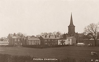
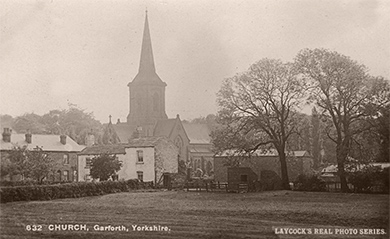
A view of Church Lane and St Mary’s from the Bar Lane railway bridge before the Oak Estate was built.
- date
- c.1915
- copyright
- Laycocks
- full size
- 2000x1228px
- postcard
- Laycocks 0632
Rose Villa
Rose Villa stood on Church Lane but was demolished to make way for Rose Court [3].
- date
- Unknown
- copyright
- Unknown
- full size
- 790x518px
- date
- Unknown
- copyright
- Unknown
- full size
- 791x543px
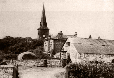
The back of Rose Villa looking past Atkinson’s farm, with St. Mary’s in the background [3].
