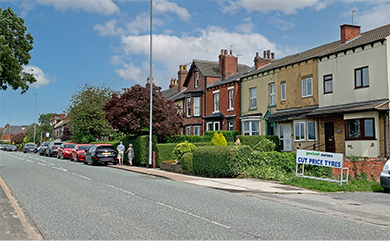
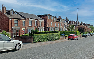
Here we follow Wakefield Road from Garforth Bridge up towards Town End at the top of Main Street where it then becomes Aberford Road. Wakefield Road bounds the West side of Garforth and as another old and original road includes some old properties as well as some of the larger Victorian terraces to be found in the town.
Over in the fields towards Leeds also lies Barrowby Hall. This lands forms the barrier of countryside between Garforth and Leeds and is what keeps Garforth separate from the general sprawl and suburbs. It will be a real shame if this area is ever filled in with housing such that Garforth then merges into Austhorpe and Cross Gates.
- date
- c.1910
- copyright
- Bramley
- full size
- 2000x1285px
- postcard
- Bramley B20
- date
- March 2019
- copyright
- Ian Atkinson
- full size
- 2000x1272px
The larger house on the right is The Beeches and the row of terraced houses beyond is Dar Villas Cottages
- date
- c.1920
- copyright
- Lilywhite
- full size
- 2000x1249px
- postcard
- Lilywhite GFH02
Dar Villas is incorrectly spelt ‘DARYILLAS’ on the postcard
- date
- c.1924
- copyright
- Lilywhite
- full size
- 2000x1246px
- postcard
- Lilywhite GFH20
The card is written ‘My hotel is in the middle’ revealing one of the buildings to be a hotel at the time (four houses are shown). The picture is taken from a similar position to the the Milton NN04 card but before the two large houses were built. The fields to the right are where Queensway now stands and Barleyhill Road can be seen beyond.
- date
- c.1930
- copyright
- Milton
- full size
- 2000x1264px
- postcard
- Milton NN04
- date
- March 2019
- copyright
- Ian Atkinson
- full size
- 2000x1313px
- date
- unknown
- copyright
- Unknown
- full size
- 2000x1221px
- postcard
- Unknown NN06
The same houses as above from the other side of the road
- date
- c.1914
- copyright
- Laycocks
- full size
- 2000x1236px
- postcard
- Laycocks 1050
- date
- June 2020
- copyright
- Ian Atkinson
- full size
- 2000x1234px
- status
- temporary image
These houses are the ones between where the petrol station used to be and Cyprus Road.
- date
- c.1907
- copyright
- Bramley
- full size
- 2000x1226px
- postcard
- Bramley B19
- date
- March 2019
- copyright
- Ian Atkinson
- full size
- 2000x1233px
The entrance to Cyprus Road is in the right of the frame. The closest two houses (the one adjacent to Cyprus Road is named Stoneleigh) used to be used as lodgings for the dairymaids at Manor Farm [3].
- date
- c.1907
- copyright
- Bramley
- full size
- 2000x1280px
- postcard
- Bramley B19-TINT
- date
- unknown
- copyright
- Richards
- full size
- 2000x1226px
- postcard
- Richards 20
- date
- c.1909
- copyright
- Phototype Co.
- full size
- 2000x1262px
- postcard
- Phototype 1885
- date
- June 2021
- copyright
- Ian Atkinson
- full size
- 2000x1262px
- status
- temporary image
Just below De Grey House. The leftmost house is called North View and the property next door is Moorfield House Surgery. Moorfield House has been a surgery since at least the early 1900s so given the age of the properties it may always have been used for this purpose.
- date
- c.1905
- copyright
- Parkinson and Roy
- full size
- 2000x1274px
- postcard
- Parkinsonandroy NN04
- date
- June 2021
- copyright
- Ian Atkinson
- full size
- 2000x1265px
- status
- temporary image
This image at the top of Wakefield Road near Town End shows De Grey house in the centre left of the frame, which was demolished in 2018 to make way for the new flats.
- date
- Unknown
- copyright
- Laycocks
- full size
- 790x454px
- postcard
- Laycocks 1032
- date
- c.1927
- copyright
- H Burniston
- full size
- 1504x945px
- postcard
- Hburniston 139


