This page contains a collection of maps and aerial photos of Garforth. At the top you can also find a Google map showing the location of many of the places mentioned on the main photo pages.
Google Map
Antiquarian Maps
- date
- 1770
- copyright
- Public domain
- full size
- 1120x1215px
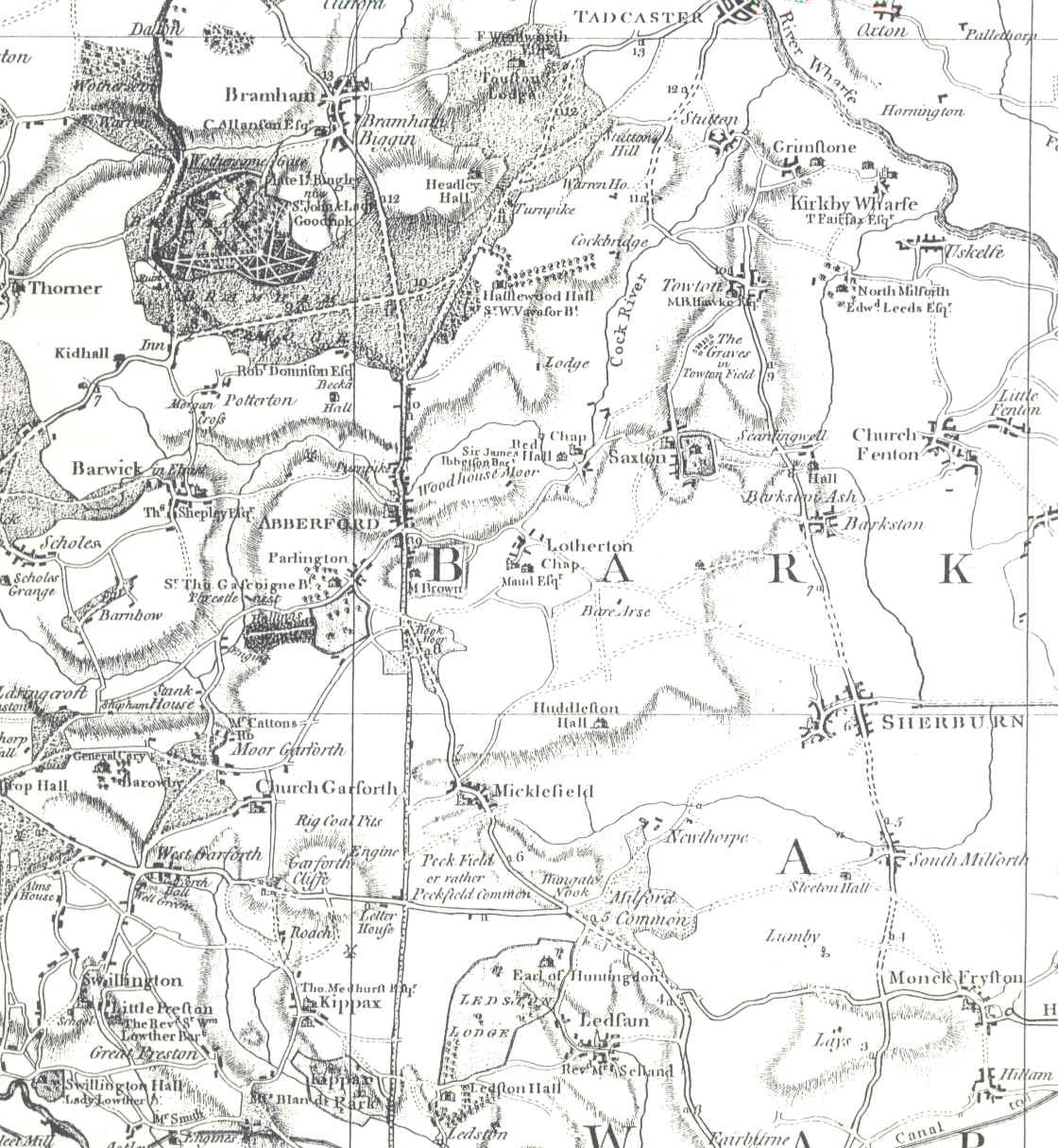
A map from 1770 by Jefferies

- date
- 1776
- copyright
- Public domain
- full size
- 700x1159px
A map from 1776 by Mostyn
Ordnance Survey Maps - High Quality
You may also be interested in the side-by-side mapping tools provided by the NLS, you can start here.
Remember to click the link next to ‘resolution’ rather than the thumbnail to see the largest image.
- date
- c.1850
- copyright
- Crown Copyright
- full size
- 4000x2286px
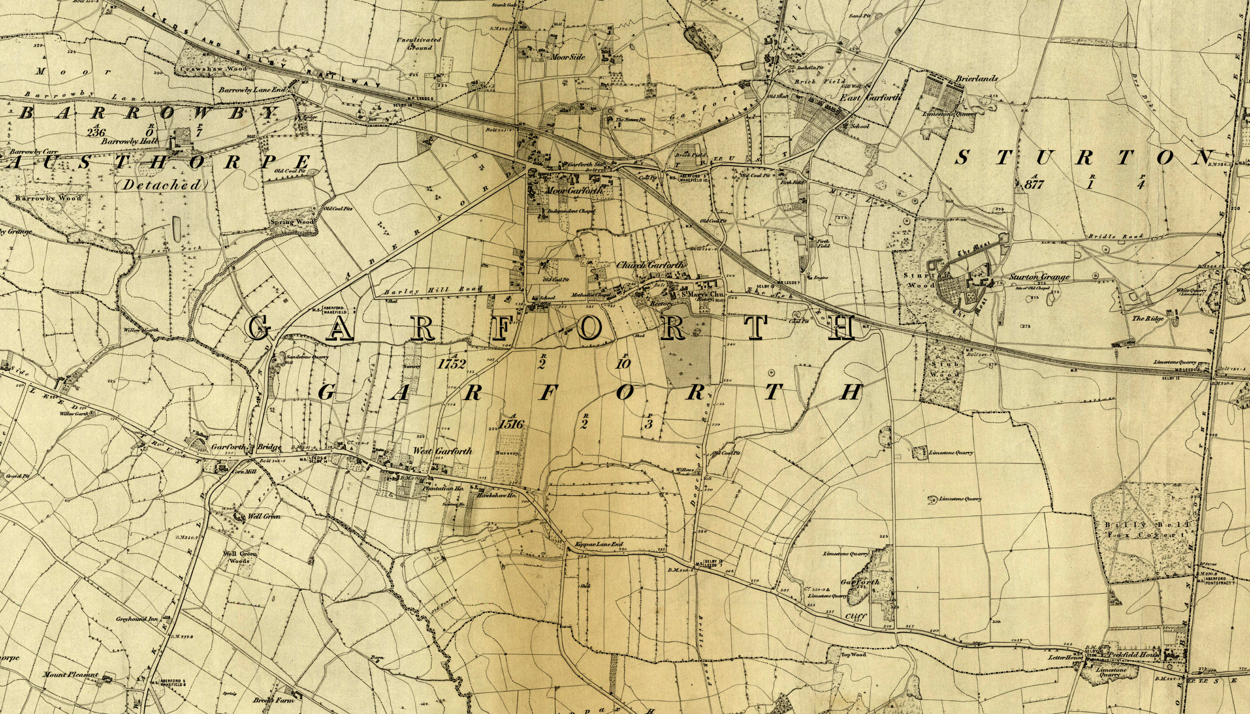
OS 6" surveyed 1845-1847, published 1850

- date
- c.1890
- copyright
- Crown Copyright
- full size
- 4000x2845px
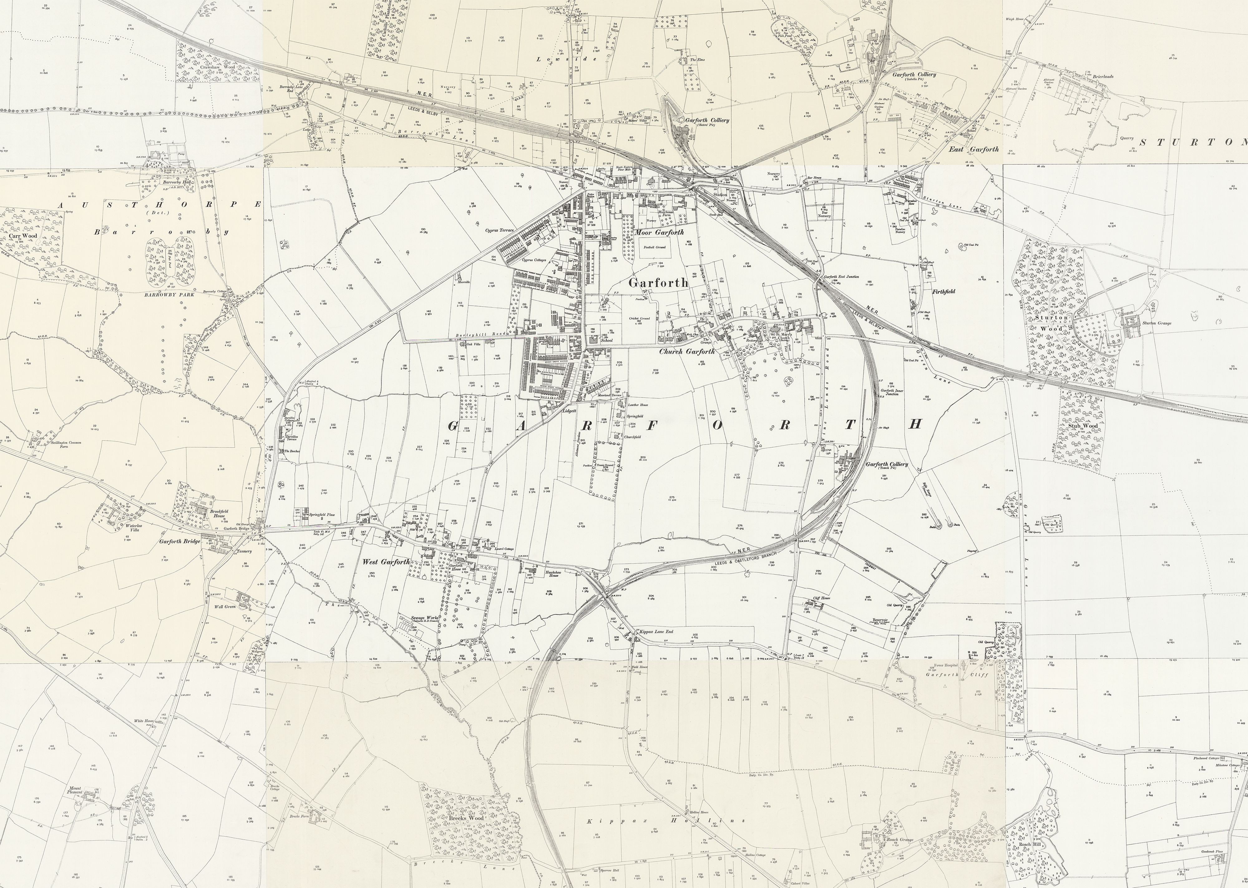
OS 6" c.1890 (1888-1913)
- date
- c.1892
- copyright
- Crown Copyright
- full size
- 4000x2844px
OS 25" surveyed 1890 published 1892

- date
- 1908
- copyright
- Crown Copyright
- full size
- 4000x2734px
OS 25" 1908 revision

- date
- 1938
- copyright
- Crown Copyright
- full size
- 4000x2678px
OS 25" 1938 revision
- date
- c.1960
- copyright
- Crown Copyright
- full size
- 4000x2857px
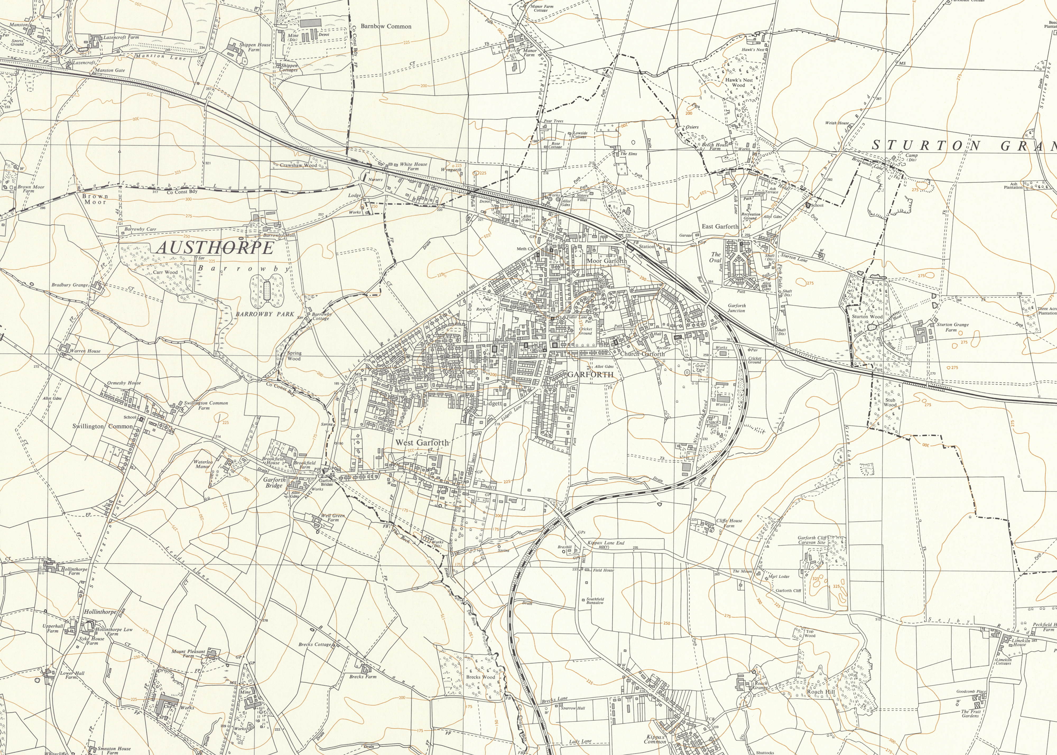
OS 6" 1949-1968. The lowthers are not shown on the 1958 map but are shown here and Springbank is not shown here but is on the 1962 aerial photos suggesting a date of c.1960 for this map.
Aerial and Satellite Photos
awaiting new photo
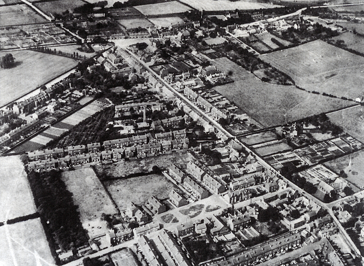
- date
- 1920s
- copyright
- Unknown
- full size
- 1183x866px
An aerial photo from the 1920s with an accompanying overlay.
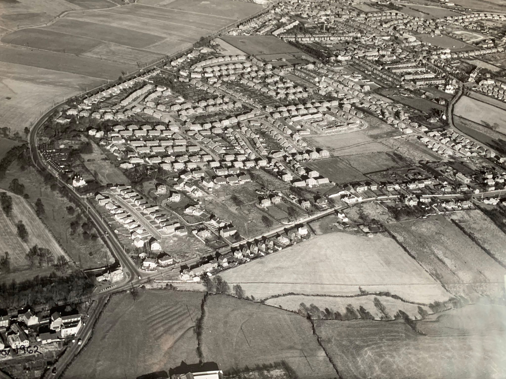
awaiting new photo
- date
- 15/11/1962
- copyright
- Unknown
- full size
- 2048x1536px
An aerial photo dating from 1962 looking down on Garforth Bridge, Selby Road and Wakefield Road (taken during the same flight as the second image below).
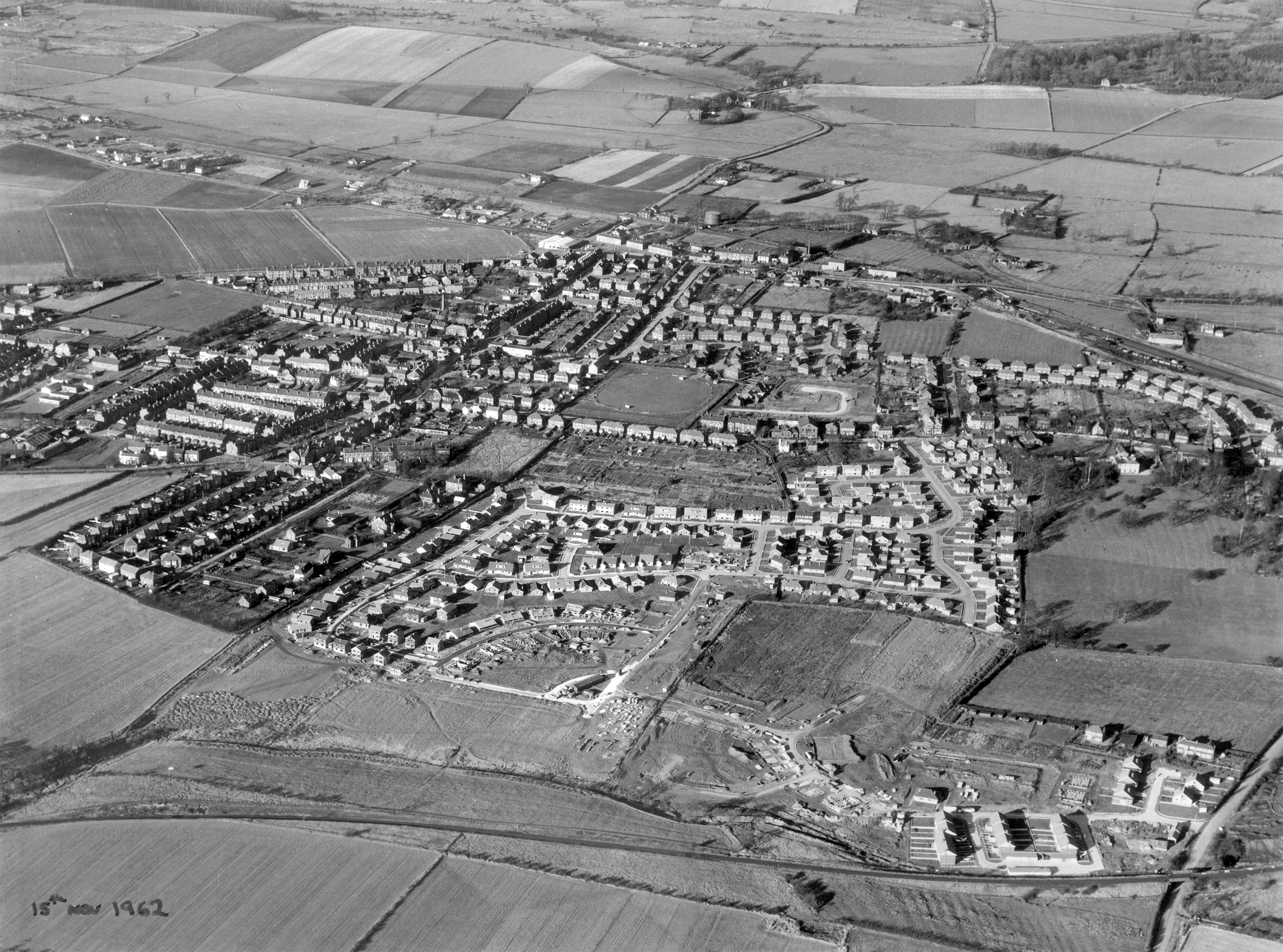
awaiting new photo
- date
- 15/11/1962
- copyright
- Unknown
- full size
- 4000x2968px
An aerial photo from 1962 with an accompanying overlay.
This is an interesting image in that you can see the Grange estate only half built
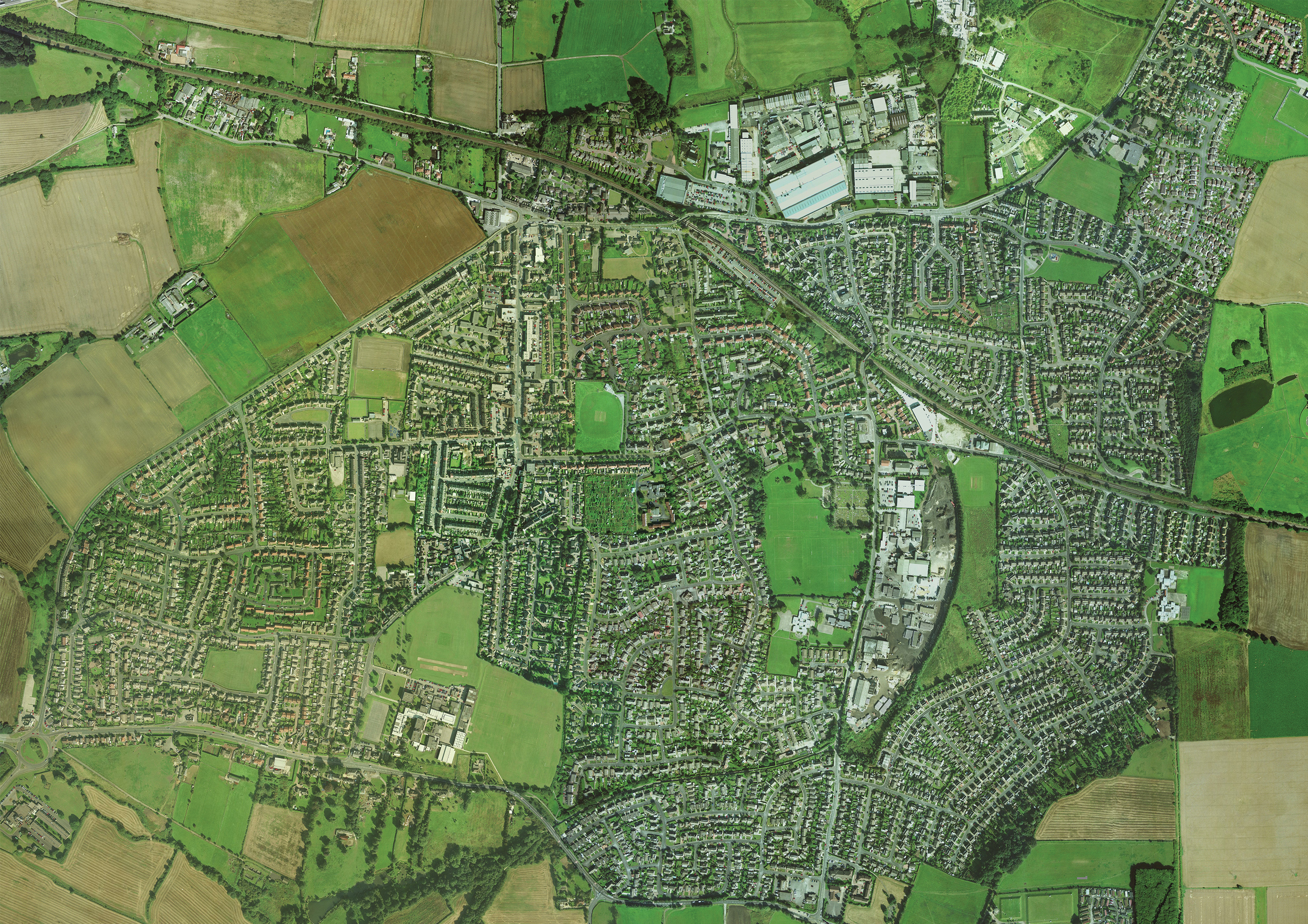
- date
- c.2000
- copyright
- full size
- 3000x2119px
Google satellite imagery from c.2000