This page contains a collection of maps of Guiseley.
Please note: the Guiseley pages are a work in progress and may take a couple of years to complete initially.
You are welcome to look at what I've done so far!
Ordnance Survey Maps - High Quality
You may also be interested in the side-by-side mapping tools provided by the NLS, you can start here.
Remember to click the link next to ‘resolution’ rather than the thumbnail to see the largest image.

- date
- c.1850
- copyright
- Crown Copyright
- full size
- 4000x2511px
OS 6" surveyed 1845-1847, published 1850

- date
- c.1890
- copyright
- Crown Copyright
- full size
- 4000x2845px
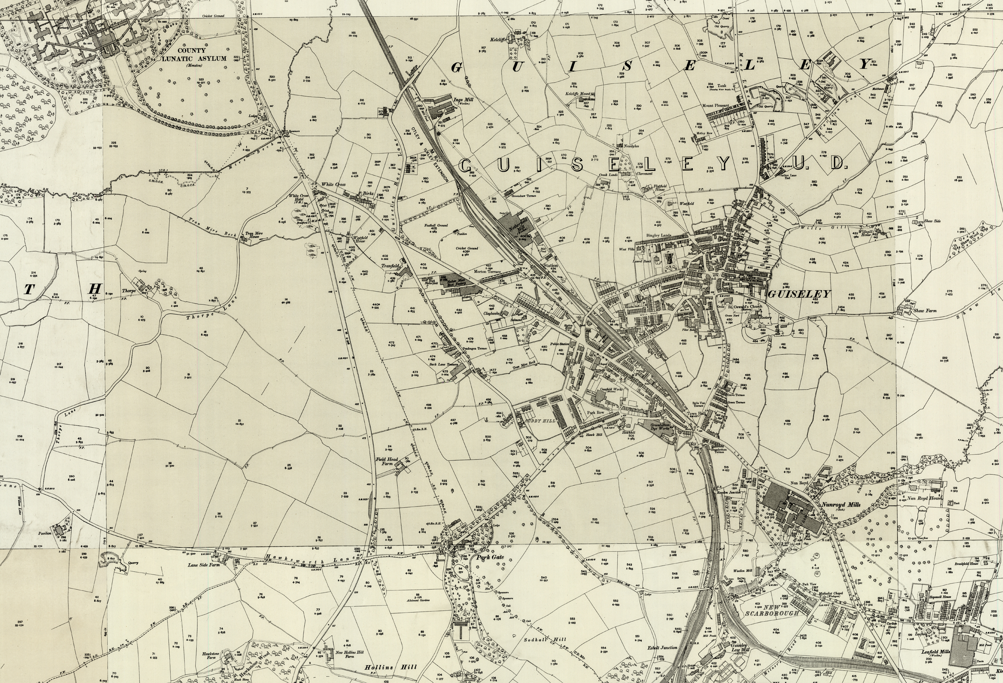
- date
- c.1892
- copyright
- Crown Copyright
- full size
- 4000x2723px
OS 25" surveyed 1890 published 1892
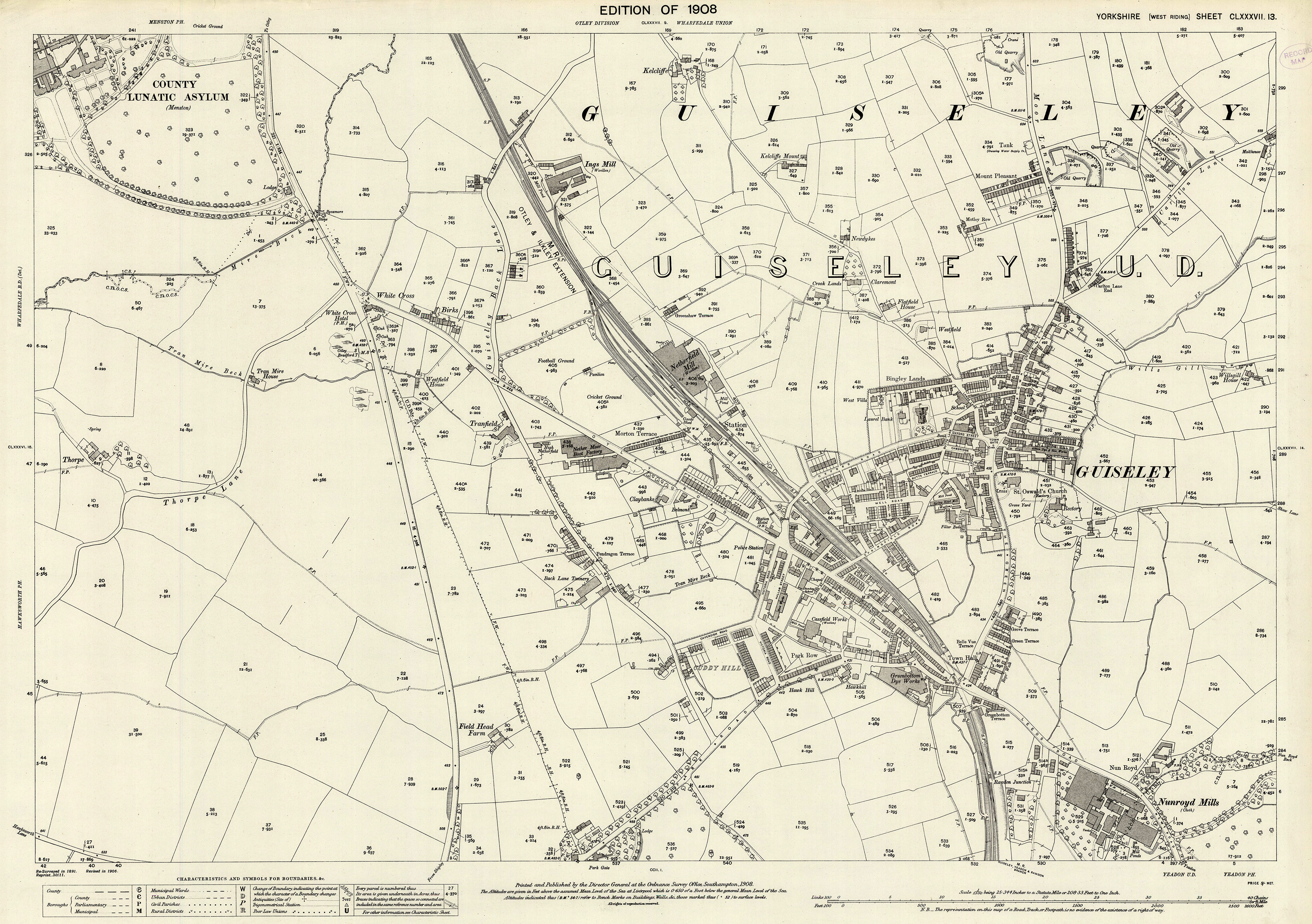
- date
- 1908
- copyright
- Crown Copyright
- full size
- 4000x2818px
OS 25" 1908 revision
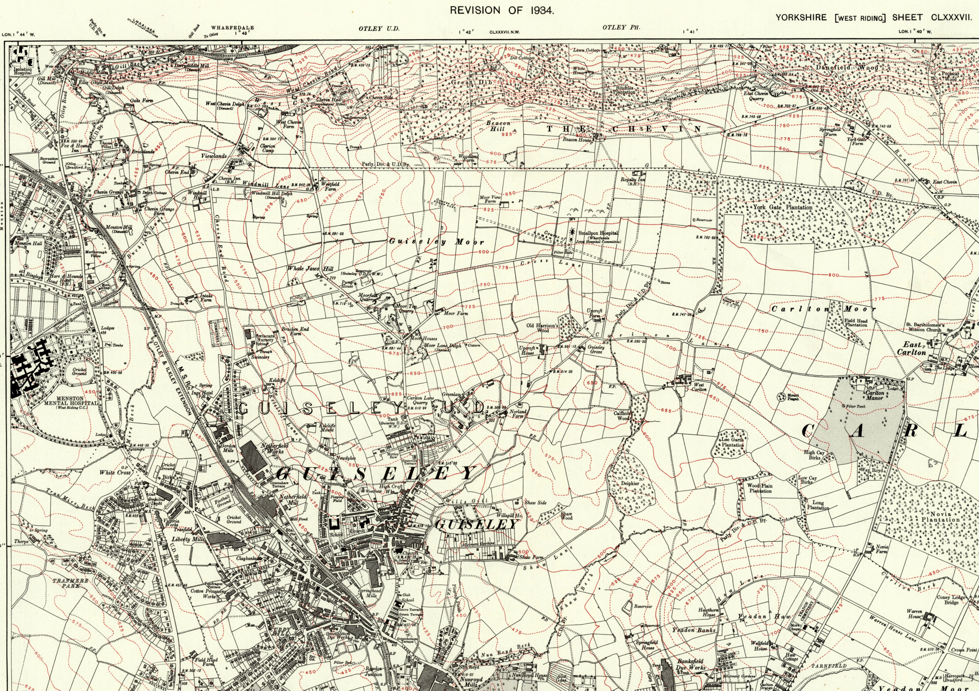
- date
- 1934
- copyright
- Crown Copyright
- full size
- 4000x2825px
OS 25" 1934 revision
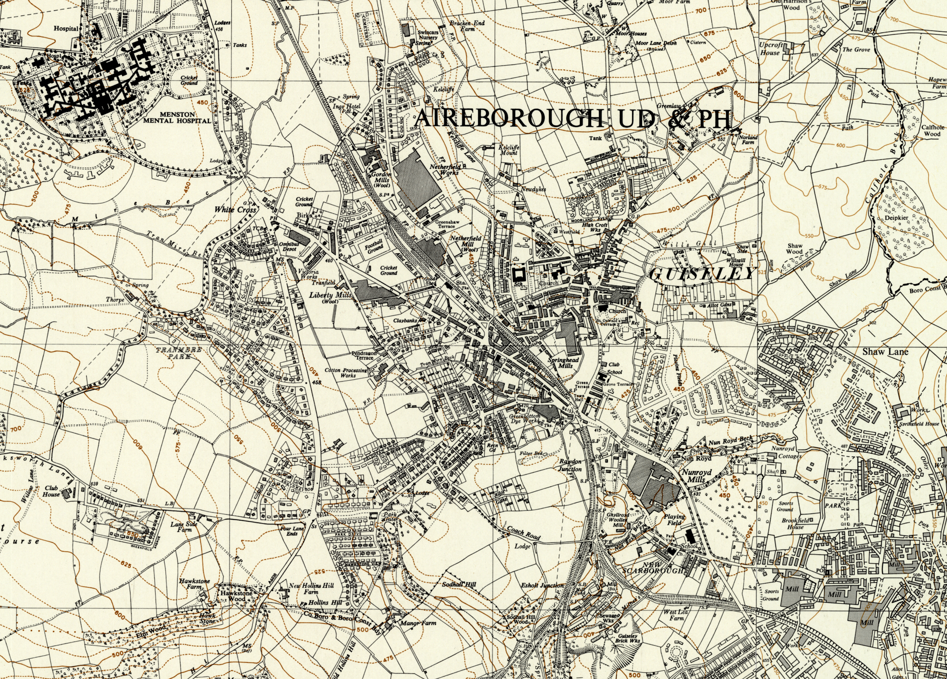
- date
- 1949-68
- copyright
- Crown Copyright
- full size
- 4000x2866px
OS 6" 1949-1968